Disclosure : This site contains affiliate links to products. We may receive a commission for purchases made through these links.
Kyrgyzstan Gizi Map
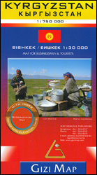
Kyrgyzstan at 1:750,000 from Gizi Map with excellent presentation of the country’s mountainous terrain through bold altitude colouring and plenty of names of mountain ranges, etc, road network indicating routes of the old Silk Road, plus a street plan of Bishkek and an administrative map of the country. All place names are in the Latin alphabet.Topography is vividly shown by bold elevation colouring, with spot heights and graphics for swamps, salt flats and deserts, plus plenty of names of mountain ranges, peaks, valleys, etc. National parks are highlighted. The map shows internal provincial boundaries and also clearly indicates the country’s Uzbek and Tadjik enclaves. Road network includes selected local tracks and highlights routes which used to the part of the old Silk Road. Railway lines are included and local airports are marked. Symbols indicate various places of interest, locations with tourist accommodation including yurt camps, etc. Latitude and longitude lines are drawn at 30’ intervals. The map has on the reverse two separate but cross-referenced indexes, in Latin and Cyrillic script. Map legend includes English.Two panels provide a street plan of central Bishkek annotated with important buildings, selected hotels and places of interest, plus a small administrative map of the country.This title is also available as a wall map.

Related Products:
 Kyrgyzstan Wall Map
 Turkmenistan Gizi Map
 Turkmenistan Gizi Wall Map
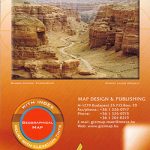
Tajikistan – The Pamirs Gizi Map
Turkmenistan Gizi Wall Map
Tajikistan – The Pamirs Gizi Map
 Tajikistan – The Pamirs Gizi Map Wall Map
 Uzbekistan Gizi Map
 Macedonia Gizi Map
 Uzbekistan Gizi Map Wall Map
 Mongolia Gizi Road Map
 Somalia Gizi Map
 Pakistan Gizi Map
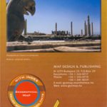 Iran Gizi Map
 Tibet Gizi Road Map
 Cuba Gizi Map
 Kazakhstan Geographical Gizi Map
 Tibet Gizi Map
 Vietnam – Laos – Cambodia Gizi Map
Kazakhstan Political Gizi Map
Vietnam – Laos – Cambodia Gizi Map
Kazakhstan Political Gizi Map
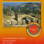 Ethiopia – Eritrea – Djibouti Gizi Map
 China Gizi Map Geographical Wall Map
 Algeria Gizi Geographical Map
 Mali Gizi Map
 Morocco Gizi Map
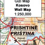 Kosovo Gizi Wall Map
 New Zealand Gizi Map
 Oman – United Arab Emirates Gizi Map
 Red Sea Gizi Map
 Caucasus Gizi Map
 North Macedonia F&B Top 10 Tips
 Libya Gizi Road Map
 Mongolia (Geographical Edition)
 Caucasus Geographical Gizi Map
 Middle East Gizi Map
 Central Asia F&B
 Sudan – South Sudan Gizi Map
 Transylvania South-Eastern Gizi Map
Afghanistan – Kabul & 5 Cities Street Plans Gizi Wall Map
Transylvania South-Eastern Gizi Map
Afghanistan – Kabul & 5 Cities Street Plans Gizi Wall Map
 Afghanistan – Kabul & 5 Cities Gizi Map
 Mongolia Geographical Edition Wall Map
 Mauritania Gizi Map