Disclosure : This site contains affiliate links to products. We may receive a commission for purchases made through these links.
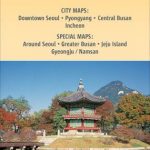
Korea South & North ITMB
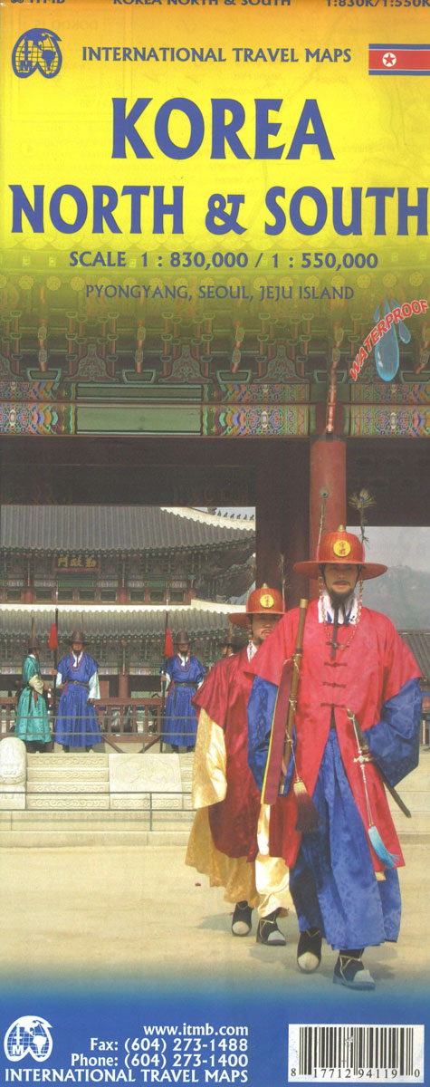
Indexed road map with Pyongyang street plan, personally researched by the president of ITMB, and complemented by a selection of his holiday photos! On the general map road detail shows highways, national roads and provincial roads. Main railways, sea ferry links, ports, international and domestic airports are also indicated. Further detail includes provincial boundaries and names, national parks and a range of symbols denoting beaches, golf courses, hot springs, tombs, temples and other sites of interest. The general relief is indicated by altitude tinting, with some peak and pass altitudes marked. Latitude and longitude lines are drawn at 1ยฐ intervals. Nb. There is no detail north of the border with China, but the coverage extends south to include Seoul.Included is a clear street map covering a substantial part of Pyongyang (1:33,000). The detail includes railways, subway lines, bus terminals, hospitals, banks, post offices and other useful landmarks and sites of interest. There is also a diagram of the Pyongyang metro network, and some useful advice for tourists is provided.

Related Products:
 China South ITMB
 Korea North and South Nelles
 Miami & South Florida ITMB
 China East – North and South Korea Reise Know-How
 South Africa – Lesotho – Swaziland ITMB
 USA South: Atlantic States ITMB
 India South & North East ITMB
 Argentina South & Tierra del Fuego ITMB
 Florida & US Deep South ITMB
 Mexico North-East ITMB
 Hanoi – Vietnam North ITMB
 Paris & France North ITMB
 British Columbia South ITMB
 Cusco & Peru South ITMB
 Scotland North & South A-Z Road Map
 South America North ITMB
 Yucatan ITMB
 Shanghai & China South East ITMB
 Santiago & Chile North ITMB
 Southeast USA – The South & Florida Borch
 England South & Wales ITMB
 Sri Lanka & India South ITMB
 San Diego & USA South West Border ITMB
 Japan South ITMB Railway & Road Map
 India North and West ITMB
 Chile South & Patagonia ITMB
 Accra & Ghana South ITMB
 Germany South ITMB
 Portugal & South of Spain ITMB
 Philippines ITMB
 China South Gizi Map
 Southern Ontario ITMB
 Guangzhou & China South ITMB
 Auckland & North Island ITMB
 Oaxaca & Chiapas ITMB
 Oslo / Bergen & South of Norway ITMB
Solomon Islands & South Pacific Ocean ITMB
Oslo / Bergen & South of Norway ITMB
Solomon Islands & South Pacific Ocean ITMB
 Ho Chi Minh City / Saigon & Vietnam South ITMB