Disclosure : This site contains affiliate links to products. We may receive a commission for purchases made through these links.
Kootenay Rockies – Calgary and Northern Montana Back Road Atlas
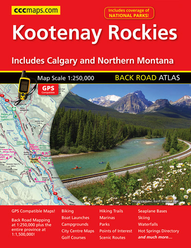
South-eastern British Columbia with the adjoining regions of Alberta including the Banff and Jasper NP plus the border area of Montana with the Glacier NP presented at 1:250,000 in an A4 paperback road atlas with additional street plans, a listing of local events, etc.Mapping at 1:250,000 covers the areas indicated on our coverage image. Landscape is well presented by relief shading with spot heights, plus names of mountain ranges, peaks and other topographic features. The region’s numerous protected areas are prominently marked. Road classification indicates unpaved or unimproved and seasonal routes; driving distances are not marked. Railway lines are included. Symbols indicate various facilities and places of interest, including campgrounds, recreational areas, tourist information centres, etc. The maps have a 10km UTM grid. The index lists communities, road names and points of interest.Additional features include: mapping at 1:4,500,000 for route planning covering BC with south-western Alberta; street plans at 1:25,000 for Banff, Jasper, Lake Louise, Canmore, Cranbrook, Golden, Invermere, Radium Hot Springs, Revelstoke and downtown Calgary, plus maps at 1:40,000 showing road access to the Calgary and Edmonton international airports; a 6-page listing of local events; a table of facilities available in the national and provincial parks; ski-&-bike and hot springs indexes; notes on camping in BC; an extensive distance chart, etc. To see the list of the currently available provincial or regional road atlases from the MapArt / Canadian Cartographics Corporation / JDM Gรฉo publishing group, please click on the series link.

Related Products:
 Vancouver to Calgary MapArt Back Road Atlas
 Alberta MapArt Back Road Atlas
 Saskatchewan Back Road Atlas
 Calgary – Banff & Enviros FastTrack
 Calgary & Southern Alberta Street Atlas
 Vancouver Island and Haida Gwaii – SW British Columbia Back Road Atlas
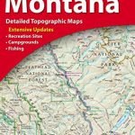
 Montana Benchmark Road & Recreation Atlas
 Ontario MapArt Back Road Atlas
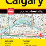 Calgary Pocket Street Atlas
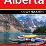 Alberta Pocket Road Atlas
 Moon Vancouver & Canadian Rockies Road Trip: Victoria, Banff, Jasper, Calgary, the Okanagan, Whistler & the Sea-To-Sky Highway
 Montana Recreational Atlas & Gazetteer
 Western & Northern Canada ITMB Travel Atlas
 Canadian Rockies – Banff – Kootenay – Yoho Parks ITMB
 Manitoba & Saskatchewan MapArt Road Atlas
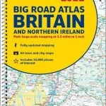 Britain and Northern Ireland Collins Big Road Atlas 2022 A3 SPIRAL-BOUND
 Iceland Road Atlas 500K
 Britain and Northern Ireland Collins Essential Road Atlas 2021
 Alps – Northern Italy MairDumont Road Atlas SPIRAL-BOUND
New Zealand Kiwimaps Travellers Road Atlas
Britain and Northern Ireland Collins Big Road Atlas 2023 A3 PAPERBACK
Alps – Northern Italy MairDumont Road Atlas SPIRAL-BOUND
New Zealand Kiwimaps Travellers Road Atlas
Britain and Northern Ireland Collins Big Road Atlas 2023 A3 PAPERBACK
 Britain and Northern Ireland Collins Big Road Atlas 2021 A3 PAPERBACK
 Britain and Northern Ireland Collins Big Road Atlas 2022 A3 PAPERBACK
Britain and Northern Ireland Collins Essential Road Atlas 2022 A4 SPIRAL-BOUND
Britain and Northern Ireland Collins Big Road Atlas 2023 A3 SPIRAL-BOUND
Great Britain & Northern Ireland A-Z Road Atlas 2023 A3 PAPERBACK
Britain and Northern Ireland Collins Big Road Atlas 2022 A3 PAPERBACK
Britain and Northern Ireland Collins Essential Road Atlas 2022 A4 SPIRAL-BOUND
Britain and Northern Ireland Collins Big Road Atlas 2023 A3 SPIRAL-BOUND
Great Britain & Northern Ireland A-Z Road Atlas 2023 A3 PAPERBACK
 Great Britain & Northern Ireland A-Z Road Atlas 2022 A3 PAPERBACK
 Great Britain & Northern Ireland A-Z Road Atlas 2021 A3 PAPERBACK
 Route 66 “The Mother Road” ITMB Road Atlas
 Calgary AB
 Calgary FastTrack
 Canada – USA – Mexico Road Atlas
 Scotland Collins Handy Road Atlas
 Croatia – Slovenia F&B Road Atlas
 Oregon & Northern California Coast Road & Recreation Map
 Canadian Rockies – Banff – Jasper – Yoho Gem Trek Map
Belarus Road Atlas
Canadian Rockies – Banff – Jasper – Yoho Gem Trek Map
Belarus Road Atlas
 Idaho Benchmark Road & Recreation Atlas
 Oregon Road & Recreation Atlas
 Oregon Benchmark Road & Recreation Atlas