Disclosure : This site contains affiliate links to products. We may receive a commission for purchases made through these links.
Know your traffic signs

Related Products:
 Traffic Signs of the World Card Game
 Traffic-Free Cycle Trails: The essential guide to over 400 traffic-free cycling trails around Great Britain
 Picture Fit: A Traffic Jam of Trucks
 Silly Signs: The Good, the Bad and the Mad
 Means of Escape Signs
Lifesaving Signs without Text – Compliant with IMO/ISO 2019
Means of Escape Signs
Lifesaving Signs without Text – Compliant with IMO/ISO 2019
 Lifesaving Signs with Text – Compliant with IMO/ISO 2019
 Peak District Cycling Country Lanes & Traffic-Free Family Routes
 Great Britain: Goldeneye Cycling Country Lanes & Traffic-Free Family Routes Maps
 The Painter of Signs
 Know your Road Signs
 Rule 10: TSS Traffic Separation Schemes
 Signs Preceding the End of the World
 I-Spy for Grown-Ups: I-Spy Signs and Instructions: You Must Obey
 Soviet Signs & Street Relics
 Japanese Notebooks: A Journey to the Empire of Signs
 The Walker`s Guide to Outdoor Clues and Signs
 Walker`s Guide To Outdoor Clues & Signs
 Signs of Life: To the Ends of the Earth with a Doctor
 Mammal Tracks and Signs of Southern Africa
 Admiralty Chart 104 – Approaches to the Humber Traffic Separation Scheme
 How to Read Water: Clues, Signs & Patterns from Puddles to the Sea
 Ultimate Signspotting – Absurd and Amusing Signs from Around the World
 CEVNI Signs & Lights Flip Cards (0069)
 The Weather Detective: Rediscovering Nature`s Secret Signs
 Poster: IMDG Code Labels, Marks & Signs
 Kent Cycling Country Lanes & Traffic Free Family Routes
 Cotswold Cycling Country Lanes & Traffic-Free Family Routes
 Norfolk Cycling Country Lanes & Traffic-Free Family Routes
 Suffolk Cycling Country Lanes & Traffic-Free Family Routes
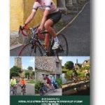
 Cotswold: Cycling Country Lanes & Traffic-Free Family Routes
 Admiralty Chart 2714 – Traffic Lanes North of Ostrov Seskar
 Escape route signs & equipment location Markings (poster)
Wild Signs and Star Paths: The Keys to Our Lost Sixth Sense
Escape route signs & equipment location Markings (poster)
Wild Signs and Star Paths: The Keys to Our Lost Sixth Sense
 Three Novels: Kingdom Cons, Signs Preceding the End of the World, The Transmigration of Bodies
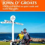 Cycling Land`s End to John o` Groats: LEJOG end-to-end on quiet roads and traffic-free paths
 Cycling Lon Las Cymru: 250 miles through the heart of Wales on traffic-free paths and quiet roads
 Exmoor – North Devon Cycling Country Lanes & Traffic-Free Family Routes
 Dartmoor South Devon Cycling Country Lanes & Traffic-Free Family Routes
 Hampshire & Isle of Wight Cycling Country Lanes & Traffic-Free Family Routes