Disclosure : This site contains affiliate links to products. We may receive a commission for purchases made through these links.
Knaresborough 1909

Knaresborough in 1909 in a fascinating series of reproductions of old Ordnance Survey plans in the Alan Godfrey Editions, ideal for anyone interested in the history of their neighbourhood or family. Most of the town is covered, stretching from Conyngham Hall eastward to Hay-a-Park. Features include the railway and station, River Nidd, Beech Hill, Spital Croft, workhouse, Castle, Tentergate, cattle market, High Street and town centre, cemetery, grammar school, etc. On the reverse are extracts from a contemporary street directory, including Bondend, Boroughbridge Road, Briggate, Castlegate, Gracious Street, High Street, Kirkgate and Market Place.About the Alan Godfrey Editions of the 25″ OS Series:Selected towns in Great Britain and Ireland are covered by maps showing the extent of urban development in the last decades of the 19th and early 20th century. The plans have been taken from the Ordnance Survey mapping and reprinted at about 15 inches to one mile (1:4,340). On the reverse most maps have historical notes and many also include extracts from contemporary directories. Most maps cover about one mile (1.6kms) north/south, one and a half miles (2.4kms) across; adjoining sheets can be combined to provide wider coverage.FOR MORE INFORMATION AND A COMPLETE LIST OF ALL AVAILABLE TITLES PLEASE CLICK ON THE SERIES LINK.

Related Products:
 Glasgow High Street 1909
 Great Driffield 1909
 Cavan Town 1909
Wrexham Central 1909
Cavan Town 1909
Wrexham Central 1909
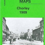 Chorley 1909
 Ayr 1909 – 33.06
Accrington 1909
Blackpool Central Pier 1909
Ayr 1909 – 33.06
Accrington 1909
Blackpool Central Pier 1909
 Bellahouston 1909 – 6.13a
Rhosllanerchrugog 1909
Birkdale 1909 – 75.13
Glasgow High Street 1933
Bellahouston 1909 – 6.13a
Rhosllanerchrugog 1909
Birkdale 1909 – 75.13
Glasgow High Street 1933
 Hull Old Town 1853
Camelford 1905
Southport (North) 1909 – 75.06b
Govan 1909
New Brighton 1909
Pollok Park 1909
Bexenden 1909
Denbigh 1910
Wrexham North 1909
Wrexham West 1909
Hull Old Town 1853
Camelford 1905
Southport (North) 1909 – 75.06b
Govan 1909
New Brighton 1909
Pollok Park 1909
Bexenden 1909
Denbigh 1910
Wrexham North 1909
Wrexham West 1909
 Stockport Town Centre 1873
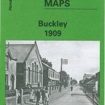 Buckley 1909
North Chorley 1909 – 77.08
Leyland 1909
Farington South and Leyland North 1909
Rotherham 1922 – 289.11b
Houghton le Spring 1895
Central Glasgow 1909 – 6.10b
Buckley 1909
North Chorley 1909 – 77.08
Leyland 1909
Farington South and Leyland North 1909
Rotherham 1922 – 289.11b
Houghton le Spring 1895
Central Glasgow 1909 – 6.10b
 Great Britain: Godfrey Editions of Historical Ordnance Survey “A Yard to the Mile” City Plans
Wick 1905
Criccieth 1913
Rose Grove and Habergham 1909
Great Britain: Godfrey Editions of Historical Ordnance Survey “A Yard to the Mile” City Plans
Wick 1905
Criccieth 1913
Rose Grove and Habergham 1909
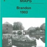 Brandon 1903
 Rossall 1909
Brecon 1903 – 28.13
Rossall 1909
Brecon 1903 – 28.13
 Hexham 1896
Oswaldtwistle and Church 1909
Barnard Castle 1897 – 52.04a
Hexham 1896
Oswaldtwistle and Church 1909
Barnard Castle 1897 – 52.04a