Disclosure : This site contains affiliate links to products. We may receive a commission for purchases made through these links.
Kluane NP YT

Kluane National Park in Yukon at 1:250,000 in a series of GPS compatible recreational maps at various scales from Go Trekkers highlighting recreational possibilities including trekking and/or snowshoe trails, canoeing and kayaking routes, campgrounds, warden stations, etc.Cartography of each title varies according to the terrain of the national park, but the maps are contoured and have spot heights plus, as appropriate, graphics to show wetlands, relief shading in mountainous areas, etc. All the titles are GPS compatible with either a UTM or latitude/longitude grid.Presentation of trails, recreational facilities such as campgrounds, access to the park by road or air, etc, also varies according to what each park has to offer and where it is situated. Each map also includes notes about the park.IN THIS TITLE: the map provides a vivid picture of the park’s topography by contours enhanced by relief shading, plus colouring/graphics to show wetlands, moraine, permanent snowfields, etc. The map highlights 42 trails, indicating which routes are regularly maintained. Symbols show locations of campgrounds and park camping sites, warden huts, picnic areas, runways and seaplane bases, etc. An enlargement shows the area around the peak of Mount Logan at 1:50,000.

Related Products:
 Wapusk National Park, Manitoba
Sirimilik National Park, Nunavut
Ukkusiksalik National Park, Nunavut
Vuntut National Park, Yukon
Ivvavik National Park, Yukon
Quttinirpaaq NP NU
Auyuittuq National Park, Nunavut
Grasslands National Park: East Block, Saskatchewan
Grasslands National Park; West Block Saskatchewan
Tuktut Nogait National Park, Northwest Territories
Prince Albert NP, Saskatchewan
Canada: Go Trekkers Maps of National Parks
Nahanni National Park Reserve, Northwest Territories
Aulavik National Park, Northwest Territories
Wapusk National Park, Manitoba
Sirimilik National Park, Nunavut
Ukkusiksalik National Park, Nunavut
Vuntut National Park, Yukon
Ivvavik National Park, Yukon
Quttinirpaaq NP NU
Auyuittuq National Park, Nunavut
Grasslands National Park: East Block, Saskatchewan
Grasslands National Park; West Block Saskatchewan
Tuktut Nogait National Park, Northwest Territories
Prince Albert NP, Saskatchewan
Canada: Go Trekkers Maps of National Parks
Nahanni National Park Reserve, Northwest Territories
Aulavik National Park, Northwest Territories
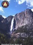 Yosemite National Park Area
 Jasper South – Jasper National Park
 Jasper North – Jasper National Park
 Banff South – Banff & Kootenay National Parks
 Banff North – Banff and Yoho National Parks
 Oregon Central
 Kootenay National Park Gem Trek Map
 Montana Recreational Atlas & Gazetteer
 Canada: NGS Trails Illustrated Maps of Banff and Jasper
 Gesรคuse National Park Kompass 206
 Missouri Recreational Atlas & Gazetteer
 Kampinoski National Park
 Ottawa National Forest MI
 West Virginia Recreational Atlas & Gazetteer
 Wyoming Recreational Atlas & Gazetteer
 Triglav Pocket Map
 Arkansas Recreational Atlas & Gazetteer
 Florida Recreational Atlas & Gazetteer
 Eifel National Park – Ahrtal K+F Outdoor Map 19
 Elbsandsteingebirge ‘“ Sรคchsische Schweiz National Park K+F Map 18
 Alabama Recreational Atlas & Gazetteer
 Folgefonna National Park Nordeca 2663
 Idaho DeLorme Atlas & Gazetteer
 South Carolina Recreational Atlas & Gazetteer
 Mississippi Recreational Atlas & Gazetteer
 Chugach State Park – Anchorage AK