Disclosure : This site contains affiliate links to products. We may receive a commission for purchases made through these links.
Kirkintilloch 1896
Kirkintilloch in 1896 in a fascinating series of reproductions of old Ordnance Survey plans in the Alan Godfrey Editions, ideal for anyone interested in the history of their neighbourhood or family. The map of Kirkintilloch, a small town just north-east of Glasgow, is double-sided. The main map covers the area from Cowgate northward to Kelvin Valley West Junction and Inchbreck, and eastward to Bridgend Farm and Meiklehill House. Features include Meiklehill Colliery Pit 5, Hillhead, Waverley Park, remains of the Antonine Wall, Langmuir Rows, Forth & Clyde Canal, Kelvinside Factory, Lion Foundry, station, High Street. On the reverse is a section of the adjacent sheet 33.06, extending coverage south and this includes Holmfield Mill, Old Aisle Burial Ground of St Ninians church, Townhead, East Greens, South Bank Iron Works, canal basins, Basin Iron Foundry and Wester Mains House.About the Alan Godfrey Editions of the 25″ OS Series:Selected towns in Great Britain and Ireland are covered by maps showing the extent of urban development in the last decades of the 19th and early 20th century. The plans have been taken from the Ordnance Survey mapping and reprinted at about 15 inches to one mile (1:4,340). On the reverse most maps have historical notes and many also include extracts from contemporary directories. Most maps cover about one mile (1.6kms) north/south, one and a half miles (2.4kms) across; adjoining sheets can be combined to provide wider coverage.FOR MORE INFORMATION AND A COMPLETE LIST OF ALL AVAILABLE TITLES PLEASE CLICK ON THE SERIES LINK.

Related Products:
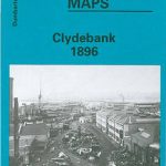 Clydebank 1896
 Lanark 1896 – 25.15
 Wishaw 1896
Broomhouse, Daldowie and Haughead 1896
Consett 1896
Norton 1896
Lenzie 1897
Wishaw 1896
Broomhouse, Daldowie and Haughead 1896
Consett 1896
Norton 1896
Lenzie 1897
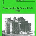 New Hartley and Delaval Hall 1896
Crook East 1896
Drumsagard Hallside & Newton 1896 – 11.06
Stranton & Southern Hartlepool 1896 – 37.15
Easington Lane and Bryn Gates 1896
Holmside and Edmondsley 1896
Darlington North 1896
New Hartley and Delaval Hall 1896
Crook East 1896
Drumsagard Hallside & Newton 1896 – 11.06
Stranton & Southern Hartlepool 1896 – 37.15
Easington Lane and Bryn Gates 1896
Holmside and Edmondsley 1896
Darlington North 1896
 Hexham 1896
North Calder & Douglas Support 1896 – 11.04
New Barnet 1896
Hexham 1896
North Calder & Douglas Support 1896 – 11.04
New Barnet 1896
 Winchmore Hill 1896 – 7.10a
 Watford South and New Bushey 1896
Willenhall & Darlaston Green 1888 – 63.09a
Milngavie 1896
Openshaw 1905
Watford South and New Bushey 1896
Willenhall & Darlaston Green 1888 – 63.09a
Milngavie 1896
Openshaw 1905
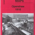 Openshaw 1916
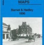 Barnet and Hadley 1896
Hayle and Lelant 1876
Barnet and Hadley 1896
Hayle and Lelant 1876
 Monken Hadley 1896
Southsea 1896 – 83.12a
Monken Hadley 1896
Southsea 1896 – 83.12a
 Falkirk 1898
Coatdyke 1897 – 8.09
Annfield Plain 1896
Bishop Middleham & Mainsforth Hall 1896 – 35.15
Bishopbriggs 1910
Stonefield, Auchinraith & Burnbank 1897 – 11.15
Shildon 1896
Glasgow North East 1893
Bishop Auckland 1896 – 42.02a
Motherwell 1896
Wivenhoe 1896
Falkirk 1898
Coatdyke 1897 – 8.09
Annfield Plain 1896
Bishop Middleham & Mainsforth Hall 1896 – 35.15
Bishopbriggs 1910
Stonefield, Auchinraith & Burnbank 1897 – 11.15
Shildon 1896
Glasgow North East 1893
Bishop Auckland 1896 – 42.02a
Motherwell 1896
Wivenhoe 1896
 Poynton West 1896
Hamilton 1896
Poynton West 1896
Hamilton 1896