Disclosure : This site contains affiliate links to products. We may receive a commission for purchases made through these links.
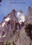
Kilimanjaro – Kibo

Kilimanjaro at 1:80,000 on an excellent map combining topographic coverage of the mountain with an enlargement for the Kibo crater, a list of GPS waypoints, street plans of Arusha and Moshi, profiles of the main routes, etc.On one side is a map of Kilimanjaro at 1:80,000 with coverage showing all four gates along the southern approaches, the Nalemoru Gate in the east and the Londorossi Gate in the west. Contours are 200m intervals, enhanced by spot heights, graphics and colouring showing exposed rock, scree, and icefields, plus different types of vegetation: cultivated land, swamps, heath and rain forest.Main routes are highlighted and other tracks are also marked, both with, where appropriate, ascent and descent markings. Symbols highlight park gates, picnic areas, campsites/huts and caves, as well as facilities in the surrounding villages. The map has a 2km UTM grid. An enlargement shows the Kibo crater and the surrounding area in greater detail and a list of GPS coordinates is provided for various points along the five main routes.Two panorama views of Kilimanjaro show the Marangu Route and Machame Route, each also presented as a route profile annotated to show changes in vegetation plus campsites and huts. The accompanying brief descriptions also cover the Rongai, Lemosho and Umbwe Routes.Street plans show Arusha and Moshi, each highlighting tourist accommodation, shops and restaurants, travel agencies and other services. The map also includes an informative panel with drawings of different types of fauna and flora along the mountain’s slopes; drawings showing the extent of permanent ice in 1912, 1962 and 2000; plus an overview road map showing north-eastern Tanzania and south-eastern Kenya, including both capitals.All the text is in English. Main map legend and route descriptions are also in German.

Related Products:
 Kilimanjaro National Park
 Kilimanjaro – Arusha F&B
 Africa`s Highest Peaks – Kilimanjaro – Mount Kenya – Rwenzori terraQuest Trekking Map
 Kilimanjaro – Summit of Africa
 Kilimanjaro & Tanzania North ITMB
 Explore Mount Kilimanjaro
 Arusha National Park
 Kilimanjaro: Ascent preparations, practicalities and trekking routes to the `Roof of Africa`
 Cotopaxi
 Snows of Kilimanjaro and Other Stories
 Kilimanjaro – Tanzania – Safari – Zanzibar
 The Snows of Kilimanjaro and Other Stories
 Skaftafell
 Gullfoss – Geysir – Hekla
 Thorns to Kilimanjaro
 Kilimanjaro: includes Mount Meru & guides to Arusha, Moshi, Marangu, Nairobi & Dar es Salaam
 Mount Kenya Map & Guide
 Kilimanjaro & Northern Tanzania Footprint Handbook
 The Shadow of Kilimanjaro
 Hornstrandir
 Snรฆfellsnes
 Italy Road Atlas A4 PAPERBACK
 Reykjanes – รingvellir
 Lรณnsรถrรฆfi – Snรฆfell
 Arusha Town and Surrounding Area
 Kjรถlur – Langjรถkull – Kerlingrafjรถll
 Babia Gรณra and Environs
 Landmannalaugar – รorsmork – Fjallabak – Eyjafjallajokull Volcano
 Kilimanjaro: A Photographic Journey to the Roof of Africa
 Akureyri – Mรฝvatn – Dettifoss
Askja – Herdubreid – Kverkfjรถll
Akureyri – Mรฝvatn – Dettifoss
Askja – Herdubreid – Kverkfjรถll
 Kilimanjaro
 Botswana Map Studio Adventure Map
 In the Footsteps of Picasso (Camรญ de Picasso) Hiking Trail
 Alta Via dei Monti Liguri Eastern Part: From Sella Giassina to Passo del Bocco 25K Ed. Multigraphic Map No. AVML3
Poland: Compass Hiking Maps
Alta Via dei Monti Liguri Eastern Part: From Sella Giassina to Passo del Bocco 25K Ed. Multigraphic Map No. AVML3
Poland: Compass Hiking Maps
 Ngorongoro Conservation Area
 Western Fjords
 Huilo Huilo Biological Reserve Trekkingchile Map
 Laguna del Maule – Winter Trails