Disclosure : This site contains affiliate links to products. We may receive a commission for purchases made through these links.
Categories
-
Best Sellers
-

Grimm Tales: For Young and Old
A phenomenal bestselling author meets the most magical stories ever told, now in a beautiful clothbound classics editionIn this stunningly designed book of classic fairy tales, Read More » -

Trucker`s Britain Philip`s Road Atlas A3 SPIRAL-BOUND
PHILIP`S – THE ATLAS BRAND FOR TRUCKERS, CARAVANNERS AND OTHER SERIOUS ROAD USERSโ€The best of its kind with quick and easy to use informationโ€ Fleet Week- Read More » -
Cambridge, Newmarket and District 1905
Cambridge, Newmarket and District in 1905 in a series of reproductions of Ordnance Survey’s famous “Inch to the Mile” maps published in the Alan Godfrey Editions Read More » -

The Vanishing Point
Stephanie Harker is travelling through security at O`Hare airport with five-year-old Jimmy. But in a moment, everything changes. In disbelief, Stephanie watches as a uniformed agent Read More » -

Sicily F&B Top 10 Tips 2-Map Set
Sicily at 1:150,000 in a set of two double-sided, GPS compatible maps from Freytag & Berndt highlighting for recommended cycle routes and best sights, with descriptions Read More » -

A Short History of Europe: From Pericles to Putin
The first short narrative history of the continent, from the author of the bestselling `A Short History of England`Europe is an astonishingly successful place. In this Read More » -

No More France Please
With the summer beckoning, life in France seems the ultimate dream for all of us rosbifs. But behind the sun, the wine, and the beautifully honey-coloured Read More » -

South Devon – Brixham to Newton Ferrers OS Explorer Active Map OL20 (waterproof)
The coast of South Devon on a detailed topographic and GPS compatible map OL20, waterproof version, from the Ordnance Survey’s 1:25,000 Explorer series. The map extends Read More » -

Berchtesgaden ‘“ Bad Reichenhall ‘“ Kรถnigsee K+F Outdoor Map 8
Berchtesgaden – Bad Reichenhall – Kรถnigsee area of the German Alps at 1:35,000 from Kรผmmerly+Frey in a series GPS compatible, double-sided maps printed on durable, waterproof Read More » -

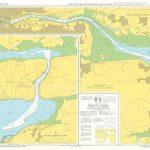
Instructional Chart 5132 – Port of Cork Upper Harbour
Admiralty Instructional charts are designed to be used for training. They contain all the features of a standard Admiralty nautical chart. PLEASE NOTE: instructional charts are Read More »
-


