Disclosure : This site contains affiliate links to products. We may receive a commission for purchases made through these links.
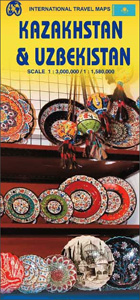
Kazakhstan & Uzbekistan ITMB

Double-sided, indexed map presenting on one side Kazakhstan at 1:3,000,000 accompanied by street plans of Astana and Almaty, with on the reverse Uzbekistan at 1:1,580,000 with street plan of Tashkent and Samarkand.Topography is shown by altitude colouring with spot heights and names of mountain ranges. The maps show the two countries’ road and railway networks, indicating the main routes of the Silk Road. Symbols highlight various places of interest. Latitude and longitude lines are drawn at 1ยบ intervals and each side has a separate index. The four street plans indicate locations of various facilities and places of interest.


