Disclosure : This site contains affiliate links to products. We may receive a commission for purchases made through these links.
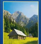
Karkonosze

Karkonosze Mountains in Poland and the Czech Republic on a detailed hiking map at 1:50,000 from EKO-GRAF, with on the reverse on overview map of hiking trails with timings, seven street plans and a sightseeing map of the region highlighting locations of palaces and other historic buildings in Poland.On one side is a detailed map at 1:50,000 straddling both sides of the border, from Jelenia Gรณra in the north to Vrchlabรญ and Janske Lรกzne, and from Harrachov to Kamienna Gรณra. The map has contours at 20m intervals and coloring for forested areas. Numerous hiking trails are coloured according to they waymarking signs and annotated with timings in both directions. Symbols indicate various types of accommodation including campsites and youth hostels. Different types of mountain transport (cable car or chair lifts, etc) are shown and local roads indicate locations of petrol station. The map has latitude and longitude lines at intervals of 5’. Map legend includes English.On the reverse a large, clear overview map shows the waymarked trails on a plainer background for planning longer connecting routes, also with timings in both directions. Street plans cover central Jelenia Gรณra and Kamianna Gรณra, plus the holiday resorts of Szklarska Poreba and Karpacz in Poland, plus Harrachov, ล pindleruv Mlรฝn and Pec pod Sneลพkou in the Czech Republic. Also provided is a road map of an area between Jelenia Gรณra and Karpacz in Poland highlighting locations of various palaces and other historic buildings. The accompanying descriptions are in Polish only.

Related Products:
 Karkonosze ExpressMap Tourist Map
 Tatra Tourist Attractions (Dookola Tatr)
 Babia Gรณra and Environs
 Poland: CartoMedia Walking Maps of Southern Polish Highlands
Parco di Veio
Parco d`Abruzzo
Poland: CartoMedia Walking Maps of Southern Polish Highlands
Parco di Veio
Parco d`Abruzzo
 Western Tatras – Polish and Slovak
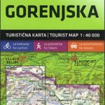 Gorenjska
 Ljubljana and Environs
 Primorska – Trieste
 Alto Sil
 Monte Velino – Altopiano delle Rocche – Monti della Duchessa
Pomurje
Posocje
Kamnik-Savinja Alps – Slovenian Carinthia
Monte Velino – Altopiano delle Rocche – Monti della Duchessa
Pomurje
Posocje
Kamnik-Savinja Alps – Slovenian Carinthia
 Bucegi Mountains
 Polish and Slovak Tatra Mountains
 Sierra de Guadarrama
 High Tatras – Polish and Slovak
 Puigmal – Vall de Nuria – Ulldeter Editorial Alpina
Poland ExpressMap Road Atlas 2020/2021
Puigmal – Vall de Nuria – Ulldeter Editorial Alpina
Poland ExpressMap Road Atlas 2020/2021
 Garrotxa – Zona Volcanica Editorial Alpina
 Tatras Central: Zakopane – Kasprowy Wierch (Tatry Reglowe)
Skofjelosko – Idrijsko – Cerkljansko Hribovje
Tatras Central: Zakopane – Kasprowy Wierch (Tatry Reglowe)
Skofjelosko – Idrijsko – Cerkljansko Hribovje
 Pohorje
 Julian Alps
 Bratislava Street Plan
Slovenia: Kartografija 40K Hiking and Cycling Sets
Bratislava Street Plan
Slovenia: Kartografija 40K Hiking and Cycling Sets
 Rajac Mountain
 Caps del Nord – Mallorca Editorial Alpina 2-Map Set
 Vall de Lord – Port del Comte Editorial Alpina
 Poland F&B Postcode Freytag & Berndt Wall Map
Beskid Maly
Poland F&B Postcode Freytag & Berndt Wall Map
Beskid Maly
 Beskid Zywiecki
 Tarcau Mountains and Ghimes Dimap Hiking Map
 Ibiza – Formentera Editorial Alpina
 Baltic Coast: Gdynia – Hel Peninsula – Nadmorski Regional Park
 Karkonosze / Riesengebirge Hรถfer Road Map
 Taga – Serra Cavallera Editorial Alpina