Disclosure : This site contains affiliate links to products. We may receive a commission for purchases made through these links.
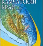
Kamchatka & Eastern Siberia ITMB
Kamchatka Peninsula at 1:1,700,000 on an indexed map at 1:1,700,000 from ITMB with an enlargement showing in greater detail the Valley of the Geysers, plus a street plan of Petropavlovsk-Kamchatsky. On the reverse is an indexed map showing a section of eastern Siberia at 1:3,600,000. All place names are in the Latin alphabet.On one side the Kamchatka administrative region is presented at 1:1,700,000 with altitude colouring plus names of mountain ranges, peaks etc, and plenty of spot heights (elevation in metres) showing its topography. Graphics indicate swamps, hot springs and geysers, glaciers, extinct volcanoes and lava fields, national parks, etc. The map shows the region’s network of main, secondary and selected other roads, indicating paved or unpaved, 4WD and winter only routes. Driving distances are marked on main routes. Symbols show local airports, locations with medical facilities, campgrounds, sport and recreational areas, etc. The map has latitude and longitude lines at 1ยบ intervals and an index of towns marked on it. Adjoining panels show in greater detail the Valley of the Geysers, main traffic routes and selected facilities in Petropavlovsk-Kamchatsky, plus the administrative division of the Kamchatka Krai into districts. Also included are notes on the peninsula’s geography and volcanoes.On the reverse is a section of eastern Siberia shown at 1:3,600,000. Coverage starts just west of Chita and extends east to include Sakhalin Island. There is an overlap with the Kamchatka map along the northern coast of the Kamchatka Peninsula; the north-easternmost part of Chukotka is not included. Topography is presented by altitude colouring (elevation in feet) with names of mountain ranges. The map shows the region’s road network, railway lines (indicating Trans-Siberian, Baikal – Amur, and Trans-Manchurian sections), and locations with air transport connections. Symbols highlight various places of interest. The map is indexed and has faint latitude and longitude lines at 5ยบ intervals.

Related Products:
 Kamchatka Krai Topographic Map
 Siberia ITMB
 Guatemala ITMB
 Spain & Portugal ITMB
 Zambia & Eastern Africa ITMB Road Map
 Iran & Tehran ITMB
 Washington DC & Eastern Corridor (Boston to DC) ITMB
 Central America ITMB
 Quito & Central Ecuador ITMB
 Belarus ITMB
 Australia ITMB
 Nepal ITMB
 Eastern Canada ITMB Travel Atlas
 Kilimanjaro & Tanzania North ITMB
 Colombia ITMB
 Cuba West ITMB
 Africa Northwest ITMB
 Singapore & Malay Peninsula ITMB
 Chad ITMB
 Africa East & Central ITMB
 Belize & Eastern Guatemala ITMB
 USA Western Railroads/Highways ITMB
 Brisbane & Queensland ITMB
 Transylvania South-Eastern Gizi Map
 Tehran & Northern Iran ITMB
 Afghanistan ITMB
 Japan North & Hokkaido ITMB
 Finland & Sweden ITMB
 South America ITMB Travel Atlas
Sweden ITMB Railway & Road Map
South America ITMB Travel Atlas
Sweden ITMB Railway & Road Map
 Rwanda & Burundi ITMB
 Mexico ITMB
 Tibet ITMB
 Southern Quebec ITMB
 Greenland & North Pole ITMB
 Santiago & Chile North ITMB
 Iceland ITMB
 Vietnam, Laos & Cambodia ITMB
 San Francisco & Northern California ITMB