Disclosure : This site contains affiliate links to products. We may receive a commission for purchases made through these links.
Kaliningrad Street Plan
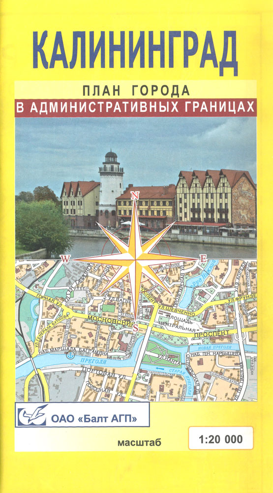
Kaliningrad street plan at 1:20,000 with an enlargement of the city’s central districts including the port, plus a road map of the environs. All place names are in Cyrillic only. Map legend and all information are in Russian.On one side is a street plan at 1:20,000 covering the city within its administrative boundary, accompanied by an index. Streets are annotated with numbers of selected buildings for easier identification of addresses. On the reverse the central districts of the city including its port are enlarged to 1:7,000. Also included are diagrams of seven main road junctions indicating the directions of the traffic, a map of the environs at 1:200,000, plus a list of main administrative offices, railway stations and port services with addresses and contact numbers.*All place names are in Cyrillic alphabet and all the text, including the map legend, is in Russian only.*IMPORTANT – PLEASE NOTE:Deliveries from Russia are very irregular and we are unable to guarantee delivery dates for maps or atlases that are not currently in stock. Specifications of maps supplied, particularly street plans, may also differ to those described on the website.

Related Products:
 Salzburg F&B Street Plan
 Moscow Jana Seta Street Plan
 Novosibirsk
 Lviv ExpressMap Street Plan
 St. Petersburg Jana Seta Street Plan
 Bishkek Street Plan
Lodz ExpressMap Street Plan
Bishkek Street Plan
Lodz ExpressMap Street Plan
 Kiev Kartografija Street Plan
 Wroclaw ExpressMap Street Plan
 Gdansk – Gdynia – Sopot (The Tricity) ExpressMap Street Plan
 Szczecin – Swinoujscie – Police ExpressMap Street Plan
 Salzburg F&B Tourist Street Plan
Warsaw – Lomianki – Zabki ExpressMap Street Plan
Salzburg F&B Tourist Street Plan
Warsaw – Lomianki – Zabki ExpressMap Street Plan
 Sofia Domino Street Plan
Kielce ExpressMap Street Plan
Sofia Domino Street Plan
Kielce ExpressMap Street Plan
 Barcelona “Maps to Go” Street Plan
 Kharkov Kartografija Street Plan
 Krakรณw – Niepolomice – Skawina – Wieliczka ExpressMap Street Plan
 Greater Oslo Cappelen Street Plan
 Katowice ExpressMap Street Plan
 Czestochowa ExpressMap Street Plan
 Doha Street Plan
 Omsk
Omsk
 Bangkok Walks Street Plan
 Vilnius Jana Seta Pocket Street Plan
 Kamianets-Podilskyi Kartografiya Street Plan
 Milan TCI Street Plan
 Lublin – Swidnik ExpressMap Street Plan
 Lviv Kartografija Street Plan
 Linz F&B Tourist Street Plan
 Poznan ExpressMap Street Plan
 Innsbruck F&B Tourist Street Plan
 Bergen Cappelen Street Plan
 Tartu Jana Seta Street Plan WATERPROOF
 Turin TCI Street Plan
 Venice TCI Street Plan
Verona TCI Street Plan
Venice TCI Street Plan
Verona TCI Street Plan
 Lithuania – Vilnius Street Plan
 Chalkidiki / Halkidiki – Thessaloniki Street Plan Terrain Editions 412
 Pรคrnu Jana Seta Street Plan WATERPROOF