Disclosure : This site contains affiliate links to products. We may receive a commission for purchases made through these links.
Categories
-
Best Sellers
-

Colonial America
Colonial America: A History to 1763, 4th Edition provides updated and revised coverage of the background, founding, and development of the thirteen English North American colonies. Read More » -

Birds of Mexico and Central America
The essential guide to identifying every species of bird you may see in this area, for tourists and wildlife enthusiasts. `Birds of Mexico and Central America, Read More » -

Azangaro
One of the maps in the topographic survey of Peru from the country’s national survey organization, Instituto Geogrรกfico Nacional. Contours are at 25m intervals and colouring/symbols Read More » -
Admiralty Chart 8101 – Fujairah and Khawr Fakkan Port Approach Guide
NEW EDITION OUT ON 01/07/2021ADMIRALTY Port Approach Guides are single, port-scale charts that contain a wide range of planning information for some of the world`s busiest Read More » -
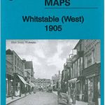
Whitstable West 1905
Whitstable West in 1905 in a fascinating series of reproductions of old Ordnance Survey plans in the Alan Godfrey Editions, ideal for anyone interested in the Read More » -

Aksu
Aksu region at 1:500,000 in a series of detailed, contoured maps of the mountains of Central Asia derived from the Soviet era topographic survey but with Read More » -

William Wenton and the Luridium Thief
A new fantasy-adventure series packed with addictive genre hooks for 9+ readers: code-breaking, cyber-technology, killer robots and a boy hero with a supernatural destiny. Perfect for Read More » -

CHS Chart 3869 – Skidegate Channel to Tian Rock
The official Canadian charts provide an excellent range of scales for the whole length of Canada`s coastline as well as the Grat Lakes and comply with Read More » -
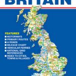
Great Britain A-Z Road Map
This Single-sided A-Z map of Great Britain is a full colour 1:840,000, fold-out road map featuring Motorways, Primary Routes, `A` Roads and a selection of other Read More » -

Hjo
Topographic survey of Sweden at 1:50,000, the Terrรคngkartan, from the Lantmรคteriet, covering most of the country in 244 double-sided maps. Please note: the mountainous regions of Read More »
-


