Disclosure : This site contains affiliate links to products. We may receive a commission for purchases made through these links.
Julian Alps F&B WK141
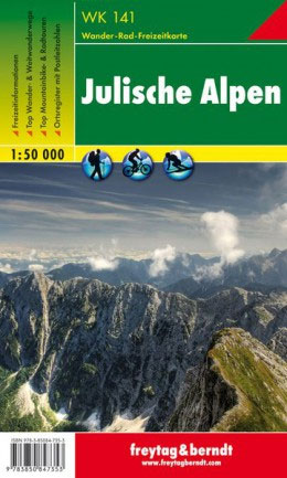
Hiking map of the Julian Alps with very clear cartography from Geodetski Zavod Slovenije. Contour interval is 20m, with additional hill-shading and graphic relief detail. An overprint highlights hiking paths, indicating poorly marked and difficult routes, also campsites and mountain refuges. Other details include: local bus stops, railways, chirlifts, skilifts, car parks, national parks, airfields, churches, castles and ruins. Margin ticks indicate latitude and longitude in steps of 5`. Map legend includes English. An accompanying booklet, in German only, includes descriptions of recommended hiking routes and places of interest.

Related Products:
 Julian Alps – Steiner Alps – Kamnik Alps Kompass 2801
 Julian Alps
 Julian Alps West Kartografija Tourist Map
 Julian Alps – Triglav National Park Kompass 064
 Julian Alps Kartografija WATERPROOF Hiking Map
 Julian Alps East – Bohinj – Triglav Tabacco 065
 Lechtal Alps – Allgau Alps F&B WK351
 Julian Alps of Slovenia: Mountain Walks and Short Treks
 Kamnik-Savinja Alps
 Zillertal – Tuxer Alps – Jenbach – Schwaz F&B WK151
 Fischbach Alps – Roseggers Waldheimat – Mรผrzzuschalg F&B WK021
 Italy: L`Escursionista Editore 25K Hiking Maps of the Italian Alps
 Lechtal Alps – Parseierspitze Alpenverein Map 3/3
 Kitzbuhel Alps East Alpenverein Map 34/2
 Central Carinthia – Gurktal Alps – Friesach – Feldkirchen – St. Veit an der Glan F&B WK231
 Stubai Alps – Hochstubai Alpenverein KOMBI Map 31/1
 Otztal Alps – Gurgl Alpenverein KOMBI Map 30/1
 Otztal Alps – Kaunergrat Alpenverein KOMBI Map 30/3
 Hohe Wand – Schneebergland – Gutenstein Alps – Piestingtal – Lilienfeld F&B WK012
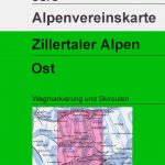 Zillertal Alps East Alpenverein KOMBI Map 35/3
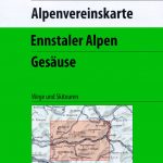 Ennstal Alps – Gesause Alpenverein KOMBI Map 16
 Zillertal Alps West Alpenverein Map 35/1
 Kitzbuhel Alps West Alpenverein Map 34/1
 Stubai Alps Central Alpenverein Map 31/4
 Lechtal Alps – Arlberg Alpenverein Map 3/2
 Allgau-Lechtal Alps East Alpenverein Map 2/2
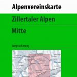 Zillertal Alps Central – Mayrhofen Alpenverein Map 35/2
 Carinthian Alps – Gailtal – Gitschtal – Nassfeld – Lesachtal – Weissensee – Upper Drautal F&B WK223
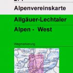 Allgau-Lechtal Alps West Alpenverein Map 2/1
Otztaler Alps – Geigenkamm Alpenverein Map 30/5
Allgau-Lechtal Alps West Alpenverein Map 2/1
Otztaler Alps – Geigenkamm Alpenverein Map 30/5
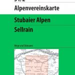 Stubai Alps – Sellrain Alpenverein KOMBI Map 31/2
 Issaquah Alps – Mount Si WA
 Lechtal Alps – Arlberg Alpenverein SKI Map 3/2
 Kitzbuhel Alps East Alpenverein SKI Map 34/2
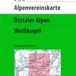 Otztal Alps – Weisskugel Alpenverein KOMBI Map 30/2
 Mountain Biking in Slovenia: Julian Alps – Gorenjska and Soca Valley, South, Central and North East
 Kitzbuhel Alps West Alpenverein SKI Map 34/1SKI
 Mayrhofen – Zillertal Alps – Gerlos – Krimml – Tuxertal – Zell im Zillertal F&B WK152
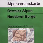 Otztal Alps – Nauderer Berge Alpenverein KOMBI Map 30/4
Lechtal Alps – Heiterwand and Muttekopfgebiet Alpenverein KOMBI Map 3/4
Otztal Alps – Nauderer Berge Alpenverein KOMBI Map 30/4
Lechtal Alps – Heiterwand and Muttekopfgebiet Alpenverein KOMBI Map 3/4