Disclosure : This site contains affiliate links to products. We may receive a commission for purchases made through these links.
Jordan
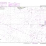
Jordan at 1:750,000 on a road map from the Royal Jordanian Geographic Centre, with a large street plan of central Amman, notes about the country, and numerous colour photos of its various sights and places of interest.The road map shows the country’s network of roads and desert tracks, indicating driving distances on main routes and locations of petrol supplies and telephone connections. Railway lines are shown with stations and the maps also shows local airports and internal administrative boundaries. Topography is shown by altitude colouring and graphics for mud pans, salt flats, and mineral springs. Symbols highlight archaeological sites, tombs and rest houses. The map has latitude and longitude lines at intervals of 30’. Outside Jordan only altitude colouring is provided, with no roads, towns or country names and with present day international boundaries. On the reverse is a street plan of central Amman showing locations of places of worship, sport facilities, petrol stations, etc. The plan is annotated with numbers highlighting locations of various hotels, embassies (?), and other facilities but, unfortunately, no list with their names is provided.All place names on the map and the plan are shown in Latin alphabet only. All the text is in English.

Related Products:
 Jordan & Syria ITMB
 Jordan – Syria – Lebanon
 Jordan F&B
 Mongolia ITMB
 Middle East ITMB Travel Atlas
 Jordan Reise Know-How
 Sao Paulo & Brazil South Coast ITMB
 Zimbabwe Map Studio Adventure Map
 Jordan: Petra – Wadi Rum – Dead Sea Footprint Handbook
 Uganda ITMB
 Macedonia Gizi Map
 Moldova
 Namibia Map Studio Adventure Map
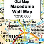 Macedonia Wall Map
 Amman
Amman
 Botswana F&B
 Bangladesh & India East ITMB
 Madagascar ITMB
 Taiwan & Taipei ITMB
 Quito & Central Ecuador ITMB
 Kenya ITMB
 Panama ITMB
 Pakistan ITMB
 Ghana ITMB
 North Macedonia F&B Top 10 Tips
 Namibia ITMB
 Lesbos Geopsis 211
 Sri Lanka & India South ITMB
 Belarus ITMB
 Chile and Santiago de Chile
 Bratislava – Slovakia
 Kefalonia – Ithaca F&B
 Singapore Periplus Travel Map
Senegal
Singapore Periplus Travel Map
Senegal
 Las Vegas ITMB
 Kos Geopsis 212
 Cayman Islands & Jamaica ITMB
 Saudi Arabia & Kuwait ITMB
 Cuba ITMB