Disclosure : This site contains affiliate links to products. We may receive a commission for purchases made through these links.
Jersey & Guernsey ITMB
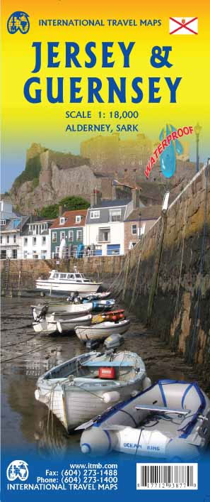
ITMB is pleased to re-introduce the Channel Islands map area after a lengthy hiatus. The islands, collectively known in English as the Channel Islands, are one of those anomalies that make Europe so attractive. There are actually, five inhabited islands, of which Jersey and Guernsey are the largest. Alderney, Sark, and Herm make up the others. Ferries link the islands, and tourism is a major activity of the islands, along with banking. Most visitors arrive on Jersey, which on our map occupies an entire side. The map shows all touristic attractions, roads, and rural restaurants/pubs. The reverse side is dominated by Guernsey, naturally, and its historic main town of St. Pete Port, but the shape of the island allowed us to include generous inset maps of Alderney and Sark, while including tiny Herm in the main map. This map has two covers: one showing Jersey and Guernsey, and the other noting Guernsey and Jersey, with two different pictures. And in the upper right corner, the flags of each island. This is one of those ‘must see before death’ touristic destinations and is well worth the visit.Legend Includes:Ferry route, Highway, Main Road, Secondary Road, Hotel, Restaurant, Port, Point of interest, Ruins / Ancient sites, Pub, Domestic Airport etc.

Related Products:
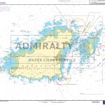
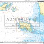
 ADMIRALTY Leisure Folio SC 5604 – Channel Islands
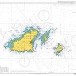
 Guernsey – Alderney, Sark & Herm Official Map
 2500 The Channel Islands and adjacent coast of France Chart Atlas – 2017 edition
 Guernsey with Alderney, Sark and Herm Sunflower Landscape Guide
 Guernsey – Herm – Sark – Alderney Insight Compact Guide OUT OF PRINT
 SHOM Chart 7160L – De Jersey ร Guernsey – Leisure A4 size
 SHOM Chart 7159 – De Guernsey, Herm et Sark ร Alderney – Bancs des Casquets
 Walking on Guernsey
 SHOM Chart 7159L – De Guernsey, Herm et Sark ร Alderney – Bancs des Casquets – Leisure A4 size
 Guernsey Flexi Map
 Admiralty Chart SC5604_9 – Guernsey, Herm and Sark
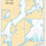
 Admiralty Chart SC5604_4 – Guernsey to Jersey
SHOM Chart 7160 – De Jersey ร Guernsey
Admiralty Chart SC5604_4 – Guernsey to Jersey
SHOM Chart 7160 – De Jersey ร Guernsey
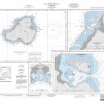
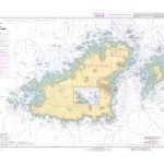
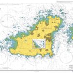
 Admiralty Chart 808 – East Guernsey – Herm and Sark
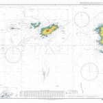
 Admiralty Chart 3654 – Guernsey Herm and Sark
 Admiralty Chart SC5604_15 – Jersey, Saint Helier – Jersey, Pierres de Lecq or Paternosters – Jersey, Les รcrรฉhous
 Walking on Jersey: 24 routes and the Jersey Coastal Walk
 Guadeloupe & Dominica ITMB
 Berlitz Pocket Guide Guernsey
 Insight Guides Great Breaks Guernsey (Travel Guide with Free eBook)
 Channel Islands Marco Polo Pocket Guide – with pull out map
 SHOM Chart 6903L – Guernsey et Herm – Leisure A4 size
 Bali & Lombok ITMB
 Admiralty Chart 3653 – Guernsey to Alderney and Adjacent Coast of France
 Dominica & Saint Lucia ITMB
 SHOM Chart 6903 – Guernsey et Herm
Sweden ITMB Railway & Road Map
SHOM Chart 6903 – Guernsey et Herm
Sweden ITMB Railway & Road Map
 The Guernsey Literary and Potato Peel Pie Society
 US/Canada Border ITMB
Florida Keys ITMB
US/Canada Border ITMB
Florida Keys ITMB
 Admiralty Chart 807 – Guernsey and Herm
 Fiji & Tonga ITMB
 Insight Guides Pocket Guernsey
 Iran & Tehran ITMB
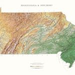 Pennsylvania and New Jersey Raven Maps Physical Wall Map PAPER
 Kyrgyzstan & Tajikistan ITMB
 Insight Guides Pocket Jersey
 Bahamas ITMB
 Arizona & New Mexico ITMB
 Virgin Islands (US and British) ITMB