Disclosure : This site contains affiliate links to products. We may receive a commission for purchases made through these links.
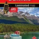
Jasper & Maligne Lake Gem Trek

Jasper – Maligne Lake area of the Jasper National Park at 1:100,000 on a GPS compatible, waterproof and tear-resistant map from Gem Trek, with very extensive tourist information including recommendations for day or longer hikes, mountain biking trails, notes on camping permits, more detailed enlargements, etc.The map covers the most popular hiking and mountain biking terrain in the Jasper National Park, extending from the Pocahontas Station in the north to Fortress Lake in the south, west beyond Jasper Townsite to Mount Fraser, and east to Coronet Creek at the southern tip of Lake Maligne. The map has contours at 50m intervals, vividly enhanced by relief shading, colouring and spot heights (given in metres and feet). An overprint highlights hiking and/or mountain biking and/or horse riding trails, indicating less well maintained routes, several types of tourist accommodation, picnic areas, viewpoints, etc. The map has a 1km UTM grid. On the reverse is extensive tourist information. 20 descriptions of day hikes cover trails from various locations: near or south of Jasper Town, Mt. Edith Cavell, Maligne Road and Lake, Miette Hot Springs. Also provided are suggestions for two- or three-day trips. Eight recommendations for mountain biking trails are graded according to difficulty. Enlargements show in greater detail Jasper Townsite, facilities at the northern end of Maligne Lake, plus Maligne Canyon. Also provided is information about backcountry camping permits, useful contact numbers, etc.To see the full list of all the titles in this series please click on the series link.


