Disclosure : This site contains affiliate links to products. We may receive a commission for purchases made through these links.
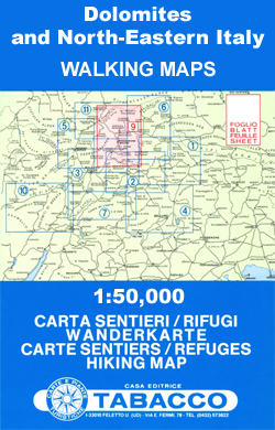
Italy: Tabacco 50K Walking Maps of the Dolomites and North-Easterm Italy

The Dolomites on hiking maps at 1:50,000 from Tabacco, with contours at 50m intervals, shading and graphic relief. An overprint highlights local footpaths, including the high level long-distance routes (Alte Vie), indicating difficult sections. The maps also show the โ€via ferrataโ€ paths along the iron rails and ladders fitted into the rock faces during the World War II to improve troop movement and now open to the public. Different types of accommodation, cable car lines, chair lifts, and various places of interest are also marked. The maps have no geographical coordinates. Map legend is in Italian and German only, unless it is indicated in the individual description that English is included.*Please note:* Maps Nos. 3, 5 and 8 are no longer in print, although they may still be recommended in some guidebooks.


