Disclosure : This site contains affiliate links to products. We may receive a commission for purchases made through these links.
Italy: Tabacco 25K Maps of the Regional Parks in South Tyrol
Protected areas of South Tyrol (Alto Adige) region of Italy in a series of hiking maps at 1:25,000 from Tabacco, with additional descriptions of geology, fauna and flora, selected routes, etc, all in Italian only, illustrated with numerous photos.The maps have similar cartography to Tabaccoโ€s other, more popular series at 1:25,000, with contours at 25m intervals, shading and graphic relief. An overprint highlights local footpaths, indicating the degree of difficulty and the state of waymarking. The maps also show the โ€via ferrataโ€ paths along the iron rails and ladders fitted into the rock faces during the World War II to improve troop movement and now open to the public. Six different types of accommodation are marked, from isolated hotels and inns to campsites and refuges, local bus stops, cable car lines and chair lifts, plus places of interest and sport facilities. On all the maps coverage extends beyond the boundaries of the protected areas to include the surrounding valleys with the main towns and villages providing bases for local excursions. Map legend includes English. For information on UTM coordinates see individual descriptions.On the reverse side are extensive notes on the area, in Italian only, illustrated with numerous colour photos. Some titles also include recommendations for hiking excursions, with the routes shown on panorama drawings. All the titles in this series are also available with German text – please contact us by e-mail.

Related Products:
 Italy: Tabacco 25K Walking Maps of the Dolomites and North-Eastern Italy
 Italy: L`Escursionista Editore 25K Hiking Maps of the Italian Alps
 Italy: Tabacco 50K Walking Maps of the Dolomites and North-Easterm Italy
 South Tyrol – Dolomites Tabacco Road and Panorama Map
 Italy: Kompass 50K Hiking Maps
 South Tyrol – Dolomites 4-Map Set Kompass 699
 Tanzania: Maco Maps of National Parks and Conservation Areas
 Bolzano Vignetei e Dolomiti / Southern South Tyrol Kompass 74
 Italy: Kompass 25K/40K Hiking Maps of the Dolomites
 Italy: IGA 25K Hiking Maps of Central Italy
 Italy: IGA 50K Hiking Maps of Central Italy
 Italy: Ed. Multigraphic Walking Maps of Central Italy
 La Strada del Vino / South Tyrol Wine Route Kompass 685
 Italy: IGC 50K Walking Maps of North-Western Italy
 Italy: IGC 25K Walking Maps of the Italian Alps
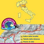
 Italy: Touring Club Italiano Regional Smart Maps
 South Tyrol Wine Route – Unterland / Bassa Atesina Kompass 074
 Zillertal Alps: Trekking and Peaks in the Austrian Tyrol and Italian South Tyrol
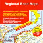
 Italy: Touring Club Italiano 200K Regional Road Maps
 Italy: Zanetti 30K Maps of the Italian Alps
 Italy: Kรผmmerly + Frey Outdoor Maps of Northern Italy
 South Africa: Map Studio Regional Tourist Maps
 Italy: Ed. Abies Recreational Maps of the Sardinian Coast
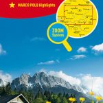
 Italy: MairDumont Marco Polo 200K Regional Road Maps
South Africa: Slingsby Maps Hiking Maps of the Cape Peninsula
Italy: MairDumont Marco Polo 200K Regional Road Maps
South Africa: Slingsby Maps Hiking Maps of the Cape Peninsula
 Italy: LAC Maps of Popular Hiking Areas
 USA: Rand McNally Regional Maps
 Germany: Marco Polo 200K Regional Road Maps
 Italy: L`Escursionista Hiking Maps of the Environs of Bologna
 Italy South Michelin Regional 564
 Norway: Nordeca Regional Touring Maps
 South Tyrol – Bolzano F&B Top 10 Tips
 Australia: Hema Regional Road Maps
 Italy: Edizioni Multigraphic 25K Walking Maps of Central Italy
 Italy: SER 25K Hiking Maps of Central Italy
 Romania: Bel Alpin Hiking Maps
 Bavaria South Marco Polo Regional Map 13
 Italy: Michelin 200K Regional Road Maps
 South Tyrol Kompass Hiking & Recreational Kompass Ring-binder Atlas No. 2703: Bormio – Merano – Bolzano – Cortina d`Ampezzo
 Italy: Ed. Multigraphic 100K Road Maps of Tuscany & Adjoining Areas