Disclosure : This site contains affiliate links to products. We may receive a commission for purchases made through these links.
Italy Reise Know-How
Italy at 1:900,000 on an indexed road map with topographic and tourist information, printed on light, waterproof and tear-resistant synthetic paper and published by Reise Know-How as part of their highly acclaimed World Mapping Project. The map is double-sided to provide the best balance between a good scale and a convenient size sheet.The map divides the country north/south, with Rome included on both sides. Road and rail networks are easy to see on a base which presents topography by altitude colouring with contours, spot heights, and names of numerous mountain ranges, valleys, and other geographical features. Road network includes local roads and gives driving distances on main routes. Also marked are ferry routes to the islands and across the Adriatic.Towns and villages worth visiting are highlighted, national/natural parks are marked, and symbols indicate various other places of interest including UNESCO World Heritage sites, other historical and cultural places, etc. The map has a grid with latitude and longitude at intervals of 1ยบ and an extensive index of localities. Map legend includes English. *”World Mapping Project”* is an extensive series of maps at varying scales, aiming to provide coverage of countries and regions worldwide using clear, well presented cartography with both topographic and tourist information.

Related Products:
 Italy North Reise Know-How
 Czechia Reise Know-How
 Istria Reise Know-How
 Turkey Reise Know-How
 Ukraine Reise Know-How
 Lithuania Reise Know-How
 Kazakhstan Reise Know-How
 Hungary Reise Know-How
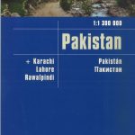 Pakistan Reise Know-How
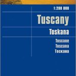 Tuscany Reise Know-How
 Corfu Reise Know-How
 Iran Reise Know-How
 Bolivia Reise Know-How
 Azores Reise Know-How
 Albania Reise Know-How
 Baja California Reise Know-How
 Peru Reise Know-How
 Venezuela Reise-Know-How Map
 Algarve Reise Know-How
 Ghana – Togo Reise Know-How
 Zimbabwe Reise Know-How
 Uganda Reise Know-How
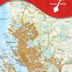
Southern Sweden and Norway Reise Know-How
Uganda Reise Know-How
Southern Sweden and Norway Reise Know-How
 Sri Lanka Reise Know-How
 Taiwan Reise Know-How
 Tanzania Reise Know-How
 Afghanistan Reise-Know-How Map
 Spain North – Santiago Route Reise Know-How
 Egypt Reise Know-How
 Guyana – Suriname – French Guiana Reise Know-How
 Trinidad and Tobago Reise Know-How
 Crimea Reise Know-How
 Yucatan Reise Know-How
 Central America Reise-Know-How Map
 Georgia Reise Know-How
 Cameroon & Gabon Reise-Know-How Map
 Africa Southern Reise Know-How
 Slovakia Reise Know-How
 Belarus Reise Know-How
 Iceland Reise Know-How