Disclosure : This site contains affiliate links to products. We may receive a commission for purchases made through these links.
Italy: Kรผmmerly + Frey Outdoor Maps of Northern Italy
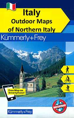
The mountains of northern Italy in a series of waterproof and tear-resistant, GPS compatible and contoured recreational maps from Kรผmmerly + Frey with both local and long-distance hiking and cycling trails, ski routes, sites for other outdoor pursuits, accommodation, bus stops, etc. Maps in this series are printed on sturdy waterproof and tear-resistant plastic. Most titles are double-sided to provide a good balance between a detailed scale and coverage of a wide area. Cartography presents a very detailed picture of the topography with contours at 40m intervals, enhanced by shading and graphic relief, plus colouring to show different types of terrain and vegetation. Boundaries of national parks and other protected areas are clearly marked.For walkers the maps show both local and long-distance trails, as well as special thematic or nature routes. Where appropriate names of the routes are shown, e.g. Sentiero Italia, Via Alpina, the Dolomites high routes, etc. The maps also highlight local and long-distance cycle routes, plus selected of mountain bike trails, ski routes and horse riding paths. A wide range of symbols indicate areas for other recreational pursuits (climbing, paragliding, Nordic walking, rafting, etc), various types accommodation (hotels/inns, mountain huts, campsites, youth hostels, etc), diverse places of interest including natural sites, sport facilities, bike hire/repair, etc. Road network indicates bus stops, restricted entry and toll roads, parking, etc. Railway lines are shown with stations. Also marked are local airports and, where appropriate, ferry connections on the lakes. The maps have a 1-km UTM grid. Map legend includes English.PLEASE NOTE: only the titles listed on our website have so far been published.

Related Products:
 Germany: Kรผmmerly+Frey Hiking and Recreational Maps
 Austria: Kรผmmerly+Frey Recreational Maps
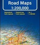 Italy: Kรผmmerly + Frey 200K Regional Road Maps
 Italy: Tabacco 25K Walking Maps of the Dolomites and North-Eastern Italy
 Switzerland: Kรผmmerly + Frey 60K Walking Maps
 Merano and Environs – Texel Group – Sarntal – Bolzano K+F Outdoor Map 2
 Cortina d`Ampezzo – Tre Cime di Lavaredo K+F Outdoor Map 6
 Lake Como K+F Outdoor Map 9
 Val Pusteria – Dolomiti di Sesto K+F Outdoor Map 5
 Val Venosta / Vinschgau K+F Outdoor Map 1
 Fichtelgebirge 35K Kรผmmerly + Frey Map No. 36
 Lower Rhine – Kleve – Wesel 50K Kรผmmerly + Frey Map No. 61
 Switzerland: Kรผmmerly + Frey 60K Cycling Maps
 Bolzano – Caldaro – Wine Route – Eggental – Neumarkt – Cavalese K+F Outdoor Map 3
 Lake Maggiore – Lake Orta – Lake Varese K+F Outdoor Map 8
 Flensburg – Schleswig 50K Kรผmmerly + Frey Map No. 9
 Hochsauerland – Rothaargebirge 50K Kรผmmerly + Frey Map No. 30
 Porta Westfalica – Minden 50K Kรผmmerly + Frey Map No. 58
Swabian Jura: Mรผnsinger Alb 35K Kรผmmerly + Frey Map No. 42
Porta Westfalica – Minden 50K Kรผmmerly + Frey Map No. 58
Swabian Jura: Mรผnsinger Alb 35K Kรผmmerly + Frey Map No. 42
 Lake Garda – Lake Idro – Monte Baldo – Verona K+F Outdoor Map 7
Black Forest: Triberg 35K Kรผmmerly + Frey Map No. 40
Lake Garda – Lake Idro – Monte Baldo – Verona K+F Outdoor Map 7
Black Forest: Triberg 35K Kรผmmerly + Frey Map No. 40
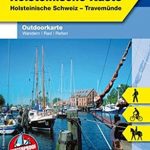
 Lรผbeck – Wismar 50K Kรผmmerly + Frey Map No. 12
 Groden – Seiseralm – Rosengarten – Sella – Marmolada K+F Outdoor Map 4
 Mรผnsterland Ost – Beckumer Berge 50K Kรผmmerly + Frey Map No. 59
 Fischland – Darร – Kรผhlungsborn 50K Kรผmmerly + Frey Map No. 13
 Black Forest: Freudenstadt 35K Kรผmmerly + Frey Map No. 39
 Swabian Jura: Hohenzollern 35K Kรผmmerly + Frey Map No. 41
 Odenwald – Heidelberg – Bergstrasse 35K Kรผmmerly + Frey Map No. 35
Naturpark Mass – Schwalm – Nette 50K Kรผmmerly + Frey Map No. 62
Odenwald – Heidelberg – Bergstrasse 35K Kรผmmerly + Frey Map No. 35
Naturpark Mass – Schwalm – Nette 50K Kรผmmerly + Frey Map No. 62
 Pfรคlzerwald (Palatinate Forest) 50K Kรผmmerly + Frey Map No. 24
 Usedom Island 50K Kรผmmerly + Frey Map No. 15
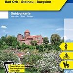
 Spessart North – Bad Orb – Steinau – Burgsinn 35K Kรผmmerly + Frey Map No. 49
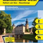 Hohe Mark / Mรผnsterland West 50K Kรผmmerly + Frey Map No. 60
 Eifel West – Schneifel 35K Kรผmmerly + Frey Map No. 34
 Spreewald – NP Dahme-Heideseen 50K Kรผmmerly + Frey Map No. 29
 Kiel – Groรer Plรถner See 50K Kรผmmerly + Frey Map No. 10
 Lower Middle Rhine: Bonn to Koblenz 35K Kรผmmerly + Frey Map No. 31
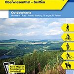 Erzegebirge – Klingenthal – Altenberg – Fichtelberg – Oberwiesenthal – Seiffen 50K Kรผmmerly + Frey Map No. 48
 Fehmarn Island – The Baltic Coast of Schleswig-Holstein 50K Kรผmmerly + Frey Map No. 11
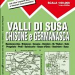 Italy: IGC 50K Walking Maps of North-Western Italy