Disclosure : This site contains affiliate links to products. We may receive a commission for purchases made through these links.
Italy: IGC 50K Walking Maps of North-Western Italy
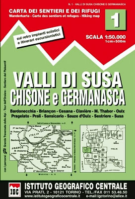
Italian Alps and Piedmont, the lakes and northern Lombardy, and the Italian Riviera at 1:50,000 from the Turin based Istituto Geografico Centrale on contoured hiking maps with local trails, long-distance footpaths, mountain accommodation, etc.The maps have contours at 50m intervals, enhanced by shading and graphic relief. An overprint highlights local footpaths and long-distance routes, including the GTA (Grande Traversata delle Alpi), Via Alpina, Tour Monte Rosa, and Alta Via del Monti Liguri – the high level route along the Ligurian Alps. Difficult sections of the routes and the Via Ferrata passages are indicated.The maps also show various types of alpine accommodation: refuges, shelters, hostels, campsites, etc. Cable car lines, chair lifts, and mountain railways are marked, as well as, for road users, entry restrictions on local tracks. Each map covers approximately 50 x 40 km / 30 x 25 miles. The maps have no geographical coordinates. Map legend includes English.* New editions now also include an overprint highlighting cycling routes, where indicated in the mapโ€s individual description.


