Disclosure : This site contains affiliate links to products. We may receive a commission for purchases made through these links.
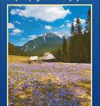
Italy: IGA 50K Hiking Maps of Central Italy

Central Italy on a series of contoured, GPS compatible hiking maps at 1:50,000 from the Istituto Geografico Adriatico, covering eastern Tuscany, with northern Umbria and the Marches, plus the south-eastern of part of Emilia-Romagna.The maps have contours at 50m intervals with additional shading and numerous spot heights. Colouring indicates different types of land use, including woodlands, olive groves, vineyards and orchards. National park and protected areas are marked.An overprint highlights local waymarked hiking routes, indicating their official number or name, including many long-distance routes such GEA (Grande Escursione Appenninica) and the course of the E1 cross-European footpath. Most titles also show cycle routes and/or mountain bike trails. A range of symbols indicate various facilities such as campsites, mountain refuges and other rural accommodation, bars and restaurants, sport and recreational places, historical and cultural monuments, etc. Road network is graded according to width, includes country tracks, and shows sections closed to motorised traffic plus locations of petrol stations.The maps have a 5km UTM, plus latitude and longitude lines at intervals of 5โ€. Map legend includes English. * *Please note: titles shown on the accompanying grid in broken lines are not yet published.*

Related Products:
 Italy: IGA 25K Hiking Maps of Central Italy
 Italy: SER 25K Hiking Maps of Central Italy
 Italy: L`Escursionista Editore 25K Hiking Maps of the Italian Alps
 France: Didier Richard Hiking Maps of South Eastern France and Corsica
 Spain: Tienda Verde Hiking Maps of Central Spain
 Italy: Fraternali Editore Hiking Maps of Southern Italian Alps
 Italy: Kompass 25K/40K Hiking Maps of the Dolomites
 Italy: Tabacco 25K Walking Maps of the Dolomites and North-Eastern Italy
 Italy: Ed. Multigraphic Walking Maps of Central Italy
 Slovenia: Kompass 75K Hiking and Cycling Maps
 Italy: Kompass 50K Hiking Maps
 Slovenia: Kartografija 75K Hiking Maps
 Bulgaria: Domino Hiking Maps
 Austria/Germany/Italy: Alpenverein Hiking & Ski Maps
 Italy: Edizioni Multigraphic 25K Walking Maps of Central Italy
 Italy: Kรผmmerly + Frey Outdoor Maps of Northern Italy
 Poland: Compass Hiking Maps
 Greece: Terrain Editions Maps for Hiking and Recreational Pursuits
Norway: Turkart 50K Topographic Hiking Maps
Greece: Terrain Editions Maps for Hiking and Recreational Pursuits
Norway: Turkart 50K Topographic Hiking Maps
 Hungary: Cartographia Hiking Maps
 Norway: Turkart 100K Topographic Hiking Maps
 Colline di Forlรญ
Alta Val Tiberina
Alta Val Marecchia
Colline di Forlรญ
Alta Val Tiberina
Alta Val Marecchia
 Austria: Freytag & Berndt Hiking Maps
 Norway: Turkart 25K Topographic Hiking Maps
Riviera Cesenate – San Marino
Norway: Turkart 25K Topographic Hiking Maps
Riviera Cesenate – San Marino
 Italy: IGC 50K Walking Maps of North-Western Italy
Appennino Tosco-Romagnolo East
Italy: IGC 50K Walking Maps of North-Western Italy
Appennino Tosco-Romagnolo East
 Italy: L`Escursionista Hiking Maps of the Environs of Bologna
 Spain: Editorial Piolet Hiking Maps
 Germany: Kรผmmerly+Frey Hiking and Recreational Maps
 Italy: F&B Walking Maps of the Dolomites
 Slovakia: Kompass 50K/25K Hiking Maps
Colline di Rimini
Alta Valle del Metauro: Valle del Candigliano, Monte Nerone, Monte Catria
Slovakia: Kompass 50K/25K Hiking Maps
Colline di Rimini
Alta Valle del Metauro: Valle del Candigliano, Monte Nerone, Monte Catria
 Greece: Anavasi Hiking Maps of Crete
 Italy: LAC Maps of Popular Hiking Areas
 Austria/Germany/Slovenia: Kompass Hiking Maps