Disclosure : This site contains affiliate links to products. We may receive a commission for purchases made through these links.
Italy Central Michelin Regional 563

Central Italy at 1:400,000 in a series of indexed touring maps from Michelin. Enlargements show road access to central Rome and Florence, with additional street plans of these two cities, all indicating principal sights and facilities, main traffic routes, one way street, and in Florence the restricted entry zone; all have a short index listing main streets. The map also indicates locations with street plans in the publishers’ Red Guide to hotels and restaurants in Italy and includes a distance table.Maps in the Michelin’s touring series of Italy show the topography by relief shading with spot heights and colouring for woodlands. Road network emphasizes motorways and dual carriageway routes, presented with service areas and interchange numbers. Information on other roads includes less congested regional roads, scenic routes, gradients, seasonal restrictions and roads not recommended for caravans, etc. More detailed presentation of the road network is provided on Michelin’s Regional Series of Italy at 1:200,000.The maps also show railway lines and ferry routes, both indicating facilities for transporting cars, plus local airports. Small symbols show various places of interest. Latitude and longitude lines are drawn at 20’ intervals. The index is on the reverse of the maps. Multilingual map legend includes English.

Related Products:
 Italy North East Michelin Regional 562
 Italy North West Michelin Regional 561
 Italy South Michelin Regional 564
 Italy: Michelin 400K Touring Maps
 Portugal Central Michelin Regional 592
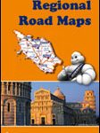
 Italy: Michelin 200K Regional Road Maps
 Central France Michelin Regional 518
 Andalucia Michelin Regional 578
 Galicia Michelin Regional 571
 Asturias – Cantabria Michelin Regional 572
 Aragon – Catalonia Michelin Regional 574
 Germany Southwest Michelin Regional 545
 Balearic Islands Michelin Regional 579
 Extremadura – Castilla-la Mancha – Madrid Michelin Regional 576
 Germany Mideast Michelin Regional 544
 Castilla y Leon – Madrid Michelin Regional 575
 Comunidad Valenciana – Murcia Michelin Regional 577
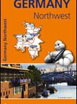 Germany North West Michelin Regional 541
 Portugal North Michelin Regional 591
 Basque Country – Navarra – La Rioja Michelin Regional 573
 Portugal South Michelin Regional 593
 Germany Southeast – Bavaria Michelin Regional 546
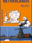 Netherlands North Michelin Regional 531
 Belgium South Michelin Regional 534
 Italy: MairDumont Marco Polo 200K Regional Road Maps
 Germany Northeast Michelin Regional 542
 Belgium North & Centre Michelin Regional 533
 Spain: Michelin Regional Road Maps
 Scotland Michelin Regional 501 WATERPROOF
 Scotland Michelin Regional 501
 Northern England – Midlands Michelin Regional 502
 Italy North F&B
 Portugal: Michelin Regional Road Maps
 Italy: Kรผmmerly + Frey 200K Regional Road Maps
 Germany Mid West Michelin Regional 543
 Wales – South West England – Midlands Michelin Regional 503
 France: Michelin 200K Regional Road Maps
 Germany: Michelin Regional Road Maps
 Italy: IGA 25K Hiking Maps of Central Italy
 Italy: IGA 50K Hiking Maps of Central Italy