Disclosure : This site contains affiliate links to products. We may receive a commission for purchases made through these links.
Israel – Palestine Reise Know-How
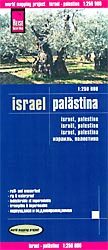
Indexed, light, waterproof and tear-resistant road map of Israel and the Palestinian Territories at 1:250,000 with topographic and tourist information, published by Reise Know-How as part of their highly acclaimed World Mapping Project. The map is double-sided, with a generous overlap between the sides. Names of larger towns are also given in Hebrew and Arabic, other locations are in the Latin alphabet only.Detailed road network (with locations of petrol stations and driving distances on main and most local routes) and railways are shown on a clear base with subtle altitude colouring to indicate the topography, including the areas below the sea level. Numerous places of interest (holy places of various denominations, UNESCO World Heritage sites, archaeological remains, national parks and reserves, beaches, etc) are highlighted in contrasting colours for easier identification. The map also shows campsites and youth hostels.The map shows the course of the separation wall with crossing points (in spring 2014 plus as planned), the pre-1967 borders indicating within the West Bank areas of full Palestinian control, the UNDOF zone in the Golan Heights, as well as international borders with crossing points. Longitude and latitude lines are drawn at 10` intervals. Extensive index has a separate list of national parks/reserves and JNF sites. Map legend includes English.”World Mapping Project” is an extensive series of maps at varying scales, aiming to provide coverage of countries and regions worldwide using clear, well presented cartography with both topographic and tourist information.


