Disclosure : This site contains affiliate links to products. We may receive a commission for purchases made through these links.
Isle of Wight AA Walker`s Map 16
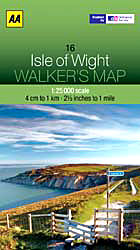
Isle of Wight at 1:25,000 in a series of Walker’s Maps published by the AA with the cartography from the Ordnance Survey’s Explorer series. The map is double-sided and coverage includes The Solent and part of the mainland with ferry connections from Portsmouth and Lymington.Maps in the AA Walker’s series are identical to the OS Explorer maps and provide plenty of recreational and tourist information, indicating in England and Wales the traditional public rights of way paths, including bridleways and byways restricted or open to motorized traffic. Also shown are other routes with public access, including permissive footpaths and bridleways. For Scotland, where different access rights apply, the maps provide an additional note explaining the regulations. Special marking indicates National Trails and Recreational Routes and for cyclists the maps show traffic-free routes and the National Cycle Network. A wide range of symbols highlights locations of special tourist interest: camping and caravanning sites, youth hostels, information offices and visitors’ centres, parking and picnicking places, historic buildings (indicating where appropriate National Trust, English Heritage, Historic Scotland or Cadw), sites for various recreational pursuits, country pubs, public toilets, etc. The maps provide detailed presentation of the topography with contours at 5 or 10m intervals, numerous spot heights and colouring and/or graphics for different types of vegetation. Additional colouring shows access land, including areas managed by the National Trust, Forestry Commission and Woodland Trust. All the standard information expected of high quality survey mapping at this scale is included: finely graded road network, railway lines with stations, cuttings or embankments, individual isolated buildings, etc.For GPS users the British National Grid is drawn at 1km intervals.

Related Products:
 Chichester & The South Downs AA Walker`s Map 20
 Isle of Wight A-Z Adventure Atlas
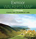 Exmoor AA Walker`s Map 13
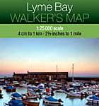 Lyme Bay 25K AA/OS Walker`s Map No. 11
 Aviemore & Central Cairngorms AA Walker`s Map 28
 West & Central Brecon Beacons AA Walker`s Map 18
 Great Britain: AA/Ordnance Survey 25K Walker`s Maps
 Snowdon & The Conway Valley AA Walker`s Map 4
 North York Moors West AA Walker`s Map 19
 North York Moors East 25K AA/OS Walker`s Map No. 12
 Eastbourne & Beachy Head AA Walker`s Map 30
 The Solent, Isle of Wight, Southampton & Portsmouth OS Landranger Map 196 (paper)
 The Solent, Isle of Wight, Southampton & Portsmouth OS Landranger Active Map 196 (waterproof)
 Isle of Man OS Landranger Map 95 (paper)
 Cotswold Way A-Z Adventure Atlas
 Hampshire & Isle of Wight Sustrans Cycle Map 6
 Isle of Arran OS Landranger Map 69 (paper)
 South Downs Way A-Z Adventure Atlas
 North Downs Way A-Z Adventure Atlas
 Pennine Way South A-Z Adventure Atlas
 Isle of Man OS Landranger Active Map 95 (waterproof)
 Exmoor A-Z Adventure Atlas
 Pembrokeshire Coast A-Z Adventure Atlas
 Isle of Arran OS Landranger Active Map 69 (waterproof)
 Pennine Way South Adventure Atlas: Edale – Bowes SUPERCEDED
 Brecon Beacons East A-Z Adventure Atlas
 North York Moors East A-Z Adventure Atlas
 South West Coast Path 5 – Dorset A-Z Adventure Atlas
 National Three Peaks Adventure Atlas: Ben Nevis, Scafell Pike, Snowdon
 Pennine Way North A-Z Adventure Atlas
Great Britain: A-Z/Ordnance Survey 25K Adventure Atlases
Pennine Way North A-Z Adventure Atlas
Great Britain: A-Z/Ordnance Survey 25K Adventure Atlases
 South West Coast Path 4 – South Devon Adventure Atlas
 South West Coast Path 3 – South Cornwall A-Z Adventure Atlas
 Yorkshire Dales South Adventure Atlas
 South West Coast Path 1 – North Devon & Somerset A-Z Adventure Atlas
 Isle of Arran OS Explorer Map 361 (paper)
 Peak District – Dark Peak A-Z Adventure Atlas
 Sittingbourne & Faversham – Isle of Sheppey OS Explorer Map 149 (paper)
 Isle of Mull East – Craignure OS Explorer Map 375 (paper)
 Isle of Axholme, Scunthorpe & Gainsborough OS Explorer Map 280 (paper)