Disclosure : This site contains affiliate links to products. We may receive a commission for purchases made through these links.
Isle of Portland: Fortuneswell and Grove 1927
Isle of Portland: Fortuneswell and Grove in 1927 in a fascinating series of reproductions of old Ordnance Survey plans in the Alan Godfrey Editions, ideal for anyone interested in the history of their neighbourhood or family. The Isle of Portland is covered by four maps. The Castletown map covers the northern part of the island, and features here include The Mere, Portland Castle, Portland station, Victoria Square, Castletown, cemeteries, Balaclava Bay, naval piers, part of the Easton & Church Hope Railway, Portland Tramway. On the reverse is part of the 1st Edition map of 1889, showing the original Portland station, Castletown, Royal Breakwater Hotel, New Coaling Camber, Breakwater Branch Railway. This title, the Fortuneswell map, climbs upwards and includes Chesil Cove, Fortuneswell centre, Verne Yeates, The Grove, Portland tramway, Nicodemus Knob, St Peter`s church and the vicarage, and numerous quarries: Tout Quarries, Trade Quarries, Inmosthay Quarries, Waycroft Quarries, Withies Croft Quarries, Independent Quarries. Prisons are left blank for security. On the reverse iis s an extract from the 1st Edition 1889 map of The Grove and this shows many sidings running into Admiralty Quarries behind Grove, leading from Admiralty Incline. The Easton and Weston map covers the centre of the island, with what might be termed its town centre, Easton. Features here include St George`s church, Easton station, Wakeham, All Saints church, remains of St Andrew`s church, Pennsylvania Castle, France Quarries, Rufus Castle, Church Hope Cove, Combefield Quarries, Suckthumb Quarries, Weston, many strip fields, Reforne Street, Easton & Church Hope Railway. On the back are extracts from a contemporary directory. The Southwell map completes the quartet and is a double-sided, taking coverage right down to Portland Bill. Features include Southwell, St Andrew`s `Avalanche` church, old and new lighthouses; but this is a more rural map, almost covered with strip fields and with smaller quarries on the west cliff. About the Alan Godfrey Editions of the 25″ OS SeriesSelected towns in Great Britain and Ireland are covered by maps showing the extent of urban development in the last decades of the 19th and early 20th century. The plans have been taken from the Ordnance Survey mapping and reprinted at about 15 inches to one mile (1:4,340). On the reverse most maps have historical notes and many also include extracts from contemporary directories. Most maps cover about one mile (1.6kms) north/south, one and a half miles (2.4kms) across; adjoining sheets can be combined to provide wider coverage.FOR MORE INFORMATION AND A COMPLETE LIST OF ALL AVAILABLE TITLES PLEASE CLICK ON THE SERIES LINK.

Related Products:
 Isle of Portland: Castletown 1927
Isle of Portland: Easton and Weston 1927
Isle of Portland: Southwell 1927
Rose Grove and Habergham 1909
Bristol (NE) 1902 – 72.13a
Guisborough 1927
Isle of Portland: Castletown 1927
Isle of Portland: Easton and Weston 1927
Isle of Portland: Southwell 1927
Rose Grove and Habergham 1909
Bristol (NE) 1902 – 72.13a
Guisborough 1927
 Penrith 1923
 Hazel Grove 1897
 Richmond South and Easby 1927
Eston 1927
Weymouth 1901
Wyke Regis 1901
Weymouth Westham 1901
Swindon South-West 1899
Swindon South-East 1899
Swindon (NW) 1899 – 15.03a
Swindon (NE) 1899 – 15.04a
Richmond South and Easby 1927
Eston 1927
Weymouth 1901
Wyke Regis 1901
Weymouth Westham 1901
Swindon South-West 1899
Swindon South-East 1899
Swindon (NW) 1899 – 15.03a
Swindon (NE) 1899 – 15.04a
 Farnham 1913
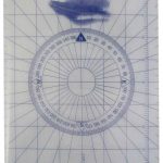 Portland Rib Plotter
 Ebbw Vale North 1899
Barnard Castle 1897 – 52.04a
South Bank and Grangetown North 1927
Bothwell & Blantyre 1897 – 11.11
Ebbw Vale North 1899
Barnard Castle 1897 – 52.04a
South Bank and Grangetown North 1927
Bothwell & Blantyre 1897 – 11.11
 Dyserth and Meliden 1910
 Darlington 1898 – 55.06a
Llantwit Major 1914
Darlington 1898 – 55.06a
Llantwit Major 1914
 Castle Douglas 1894
Norwich (North) 1905 – 63.11
Castle Douglas 1894
Norwich (North) 1905 – 63.11
 Norwich (South) 1905 – 63.15
 Peckham 1894 – 103.2
 Peckham 1914 – 103.3
Peckham 1871 – 103.1
Peckham 1914 – 103.3
Peckham 1871 – 103.1
 Portland OR Rand McNally
Whitehaven 1923
Portland OR Rand McNally
Whitehaven 1923
 Banbridge 1903
Sherborne 1901
Llandovery 1904 – 18.13
Criccieth 1913
Cockermouth 1898
Trimdon Grange 1914
Banbridge 1903
Sherborne 1901
Llandovery 1904 – 18.13
Criccieth 1913
Cockermouth 1898
Trimdon Grange 1914