Disclosure : This site contains affiliate links to products. We may receive a commission for purchases made through these links.
Ireland NGS Executive Wall Map PAPER
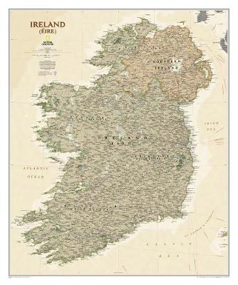
A wall map of Ireland with Northern Ireland at 1:550,000, 76 x 91cm (2ft 6″ x 3ft approx) ‘“ paper version, from the National Geographic Society in their executive style designed to present current information in colouring reminiscent of antique maps with shades of beige and brown. Where appropriate, both Irish and English place names are shown.The map presents the island of Ireland on a base with relief shading to indicate mountain ranges and shows the network of road and rail connections. Also shown are airports with scheduled services, ferry connections to Britain and important historical or other sites.County boundaries are marked and within the Irish Republic county names are shown in both English and Irish. Also shown, but without boundaries, are the names of the four traditional regions of Ireland: Ulster, Connacht, Leinster and Munster. Throughout the map, but particularly in the predominantly Irish-speaking parts names of towns are shown in both English and Irish. * This map is also available encapsulated.

Related Products:
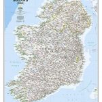 Ireland NGS Classic Wall Map PAPER
 Ireland NGS Executive Wall Map ENCAPSULATED
 Ireland NGS Classic Wall Map ENCAPSULATED
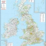
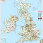
 Britain and Ireland NGS Executive Wall Map PAPER
 Britain and Ireland NGS Classic Wall Map PAPER
 Scotland NGS Executive Wall Map PAPER
 Great Britain & Ireland Michelin Wall Map PAPER
 Britain and Ireland NGS Executive Wall Map ENCAPSULATED
 Scotland NGS Classic Wall Map PAPER
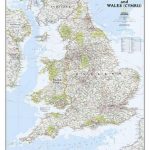
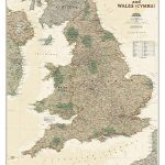 England and Wales NGS Executive Wall Map PAPER
 Great Britain & Ireland Michelin Wall Map ENCAPSULATED
 Europe NGS Executive Wall Map PAPER
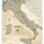 Italy NGS Executive Wall Map PAPER
 Europe NGS Executive Wall Map LARGE PAPER
 Britain and Ireland NGS Classic Wall Map ENCAPSULATED
 Germany NGS Executive Wall Map PAPER
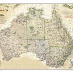 Australia NGS Executive Wall Map PAPER
 Asia NGS Executive Wall Map PAPER
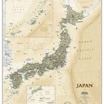 Japan NGS Executive Wall Map PAPER
 Scotland NGS Executive Wall Map ENCAPSULATED
 Ireland AA Road Atlas
 Africa NGS Executive Wall Map PAPER
 Ireland Adventure Map
 Great Britain: The Daily Telegraph Wall Map of Great Britain & Ireland
 France, Belgium and Netherlands NGS Classic Wall Map PAPER
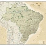 Brazil NGS Executive Wall Map PAPER
 Ireland Hallwag Road Map
 Balkans NGS Classic Wall Map PAPER
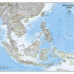 Southeast Asia NGS Classic Wall Map PAPER
 Great Britain & Northern Ireland ReiseKnow-How Map
 England and Wales NGS Classic Wall Map PAPER
 Great Britain: The Daily Telegraph Wall Map of Great Britain & Ireland (ENCAPSULATED)
Mexico NGS Executive Wall Map PAPER
Great Britain: The Daily Telegraph Wall Map of Great Britain & Ireland (ENCAPSULATED)
Mexico NGS Executive Wall Map PAPER
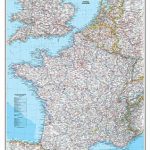
 France, Belgium and Netherlands NGS Executive Wall Map PAPER
 North America NGS Executive Wall Map PAPER
 India NGS Classic Wall Map PAPER
 Scotland NGS Classic Wall Map ENCAPSULATED
 Central America NGS Classic Wall Map PAPER
 Ireland Marco Polo Map
 Ireland: Ordnance Survey of Ireland 50K Discovery Maps