Disclosure : This site contains affiliate links to products. We may receive a commission for purchases made through these links.
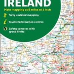
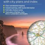
Ireland Collins Handy Map

Easy-to-use route-planning map covering the whole of Ireland opens almost like a book. It has the convenience of an atlas with all the benefits of a fold out map, and features clear, full-colour road maps at 10 miles to 1 inch plus city centre plans of Belfast and Dublin.The map is laminated on both sides making it very hard wearing and comes in a plastic wallet.Features include:’
: Clear detailed mapping with attractive layer colours showing height’
: Places of tourist interest and Tourist Information Centres shown’
: Distance chart on the back of the map in both miles and kilometres’
: Distances shown on the roads to aid journey planning

Related Products:
 Ireland Collins Handy Road Atlas
 Britain and Northern Ireland Collins Essential Road Atlas 2021
 Britain and Northern Ireland Collins Essential Road Atlas 2022 A4 SPIRAL-BOUND
 Scotland Collins Handy Road Atlas
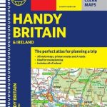
 Britain and Ireland Collins Handy Road Atlas 2022 A5 SPIRAL-BOUND
 Wild Atlantic Way Collins Pocket Map – The perfect way to explore Ireland`s western coastline
 Britain and Ireland Collins Handy Road Atlas 2021 A5 SPIRAL-BOUND
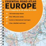
 Europe Collins Handy Road Atlas
Britain and Ireland Collins Handy Road Atlas 2023 A5 SPIRAL-BOUND
Europe Collins Handy Road Atlas
Britain and Ireland Collins Handy Road Atlas 2023 A5 SPIRAL-BOUND
 Ireland Collins Road Atlas Touring Edition
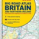
 Britain and Northern Ireland Collins Big Road Atlas 2021 A3 PAPERBACK
 Britain and Northern Ireland Collins Big Road Atlas 2022 A3 PAPERBACK
 Ireland Collins Road Map 2021
Britain and Northern Ireland Collins Big Road Atlas 2023 A3 PAPERBACK
Ireland Collins Road Map 2023
Britain and Northern Ireland Collins Big Road Atlas 2023 A3 SPIRAL-BOUND
Ireland Collins Road Map 2021
Britain and Northern Ireland Collins Big Road Atlas 2023 A3 PAPERBACK
Ireland Collins Road Map 2023
Britain and Northern Ireland Collins Big Road Atlas 2023 A3 SPIRAL-BOUND
 Britain and Northern Ireland Collins Big Road Atlas 2022 A3 SPIRAL-BOUND
 Outer Hebrides Collins Pocket Map
 Orkney Collins Pocket Map – The perfect way to explore Orkney
 Cornwall Collins Pocket Map – The perfect way to explore Cornwall
 Scotland Collins Pocket Map
 Northern Ireland Collins Pocket Map – The perfect way to explore Northern Ireland
 Wales Collins Pocket Map – The perfect way to explore Wales
 Europe Collins Essential Road Atlas 2021 A4 SPIRAL-BOUND
 Britain & Ireland Philip`s Handy Road Atlas A5 SPIRAL-BOUND
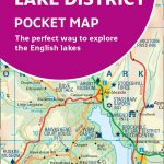 Lake District Collins Pocket Map – The perfect way to explore the English lakes
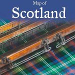 Scotland Collins Tartans Map
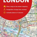 London Collins Handy Street Map
Scotland Collins Road Map 2023
Ireland Collins Comprehensive Road Atlas
London Collins Handy Street Map
Scotland Collins Road Map 2023
Ireland Collins Comprehensive Road Atlas
 Ireland Collins Touring Map
Scotland Collins Pocket Map – The perfect way to explore Scotland
Ireland Collins Touring Map
Scotland Collins Pocket Map – The perfect way to explore Scotland
 Europe Collins Essential Road Atlas A4 SPIRAL-BOUND
NC500 Collins Pocket Map – The perfect way to explore North Scotland
Europe Collins Essential Road Atlas A4 SPIRAL-BOUND
NC500 Collins Pocket Map – The perfect way to explore North Scotland
 Fife Collins Pocket Map
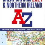
Great Britain & Northern Ireland A-Z Road Atlas 2023 A3 PAPERBACK
Fife Collins Pocket Map
Great Britain & Northern Ireland A-Z Road Atlas 2023 A3 PAPERBACK
 Great Britain & Northern Ireland A-Z Road Atlas 2022 A3 PAPERBACK
 Great Britain & Northern Ireland A-Z Road Atlas 2021 A3 PAPERBACK
 Ireland: Collins Road Atlases
 Ireland Philip`s Road Map