Disclosure : This site contains affiliate links to products. We may receive a commission for purchases made through these links.
Inverness West 1903

Inverness West in 1903 in a fascinating series of reproductions of old Ordnance Survey plans in the Alan Godfrey Editions, ideal for anyone interested in the history of their neighbourhood or family. The map covers the western part of Inverness, stretching from Castle Street westward to the Caledonian Canal and Kinmylies, and from Rose Street and Glebe Street southward to Ballifeary. Features include River Ness, Glebe area, St Andrew`s Cathedral, Northern Infirmary, Victoria Park, Ballifeary area, Tomnahurich, much of Muirtown Ward, Muirtown Green, County Buildings, Haugh area, Tweedmouth Methodist Chapel, Suspension Bridges, Academy Street, Church Street, Glenmhor Distillery, etc.About the Alan Godfrey Editions of the 25″ OS Series:Selected towns in Great Britain and Ireland are covered by maps showing the extent of urban development in the last decades of the 19th and early 20th century. The plans have been taken from the Ordnance Survey mapping and reprinted at about 15 inches to one mile (1:4,340). On the reverse most maps have historical notes and many also include extracts from contemporary directories. Most maps cover about one mile (1.6kms) north/south, one and a half miles (2.4kms) across; adjoining sheets can be combined to provide wider coverage.FOR MORE INFORMATION AND A COMPLETE LIST OF ALL AVAILABLE TITLES PLEASE CLICK ON THE SERIES LINK.

Related Products:
 Sheffield (West) 1903 – 294.07b
 Redditch West 1903
Redditch East 1903
Honiton 1903
Redditch West 1903
Redditch East 1903
Honiton 1903
 Brandon 1903
 Banbridge 1903
Brecon 1903 – 28.13
Crickhowell & Llangattock 1903
Banbridge 1903
Brecon 1903 – 28.13
Crickhowell & Llangattock 1903
 Shrewsbury West 1900
Northfield North 1903
Lyme Regis 1903
King`s Norton 1903
Sheffield (North) 1903 – 294.04b
Sheffield Ecclesall Road and Sharrow 1903
Axminster 1903 – 72.05
Northfield South 1903
Shrewsbury West 1900
Northfield North 1903
Lyme Regis 1903
King`s Norton 1903
Sheffield (North) 1903 – 294.04b
Sheffield Ecclesall Road and Sharrow 1903
Axminster 1903 – 72.05
Northfield South 1903
 Great Britain: Godfrey Editions of Historical Ordnance Survey “A Yard to the Mile” City Plans
Shotts (West) 1939 – 13.06
Great Britain: Godfrey Editions of Historical Ordnance Survey “A Yard to the Mile” City Plans
Shotts (West) 1939 – 13.06
 Evesham North 1903
Maldon West 1920 – 55.16
South Yardley and Hay Mills 1903
Bearwood 1903
Sheffield Park 1903
Sheffield Heeley 1903
Selly Oak and Bournville 1903
Evesham North 1903
Maldon West 1920 – 55.16
South Yardley and Hay Mills 1903
Bearwood 1903
Sheffield Park 1903
Sheffield Heeley 1903
Selly Oak and Bournville 1903
 Sale South-West 1908
 The West End 1894 – 61.2
 Newquay West 1933
Nether Edge 1903
Sheffield Central 1903
Walthamstow West 1913
Newquay West 1933
Nether Edge 1903
Sheffield Central 1903
Walthamstow West 1913
 Walthamstow West 1936 – 14.3
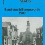 Evesham and Bengeworth 1903
The West End 1914 – 61.3
Evesham and Bengeworth 1903
The West End 1914 – 61.3
 West Drayton South 1935
Hall Green 1903
Shut End and Tansey Green 1903
Tiverton 1903
Sheffield Darnall 1903
West Drayton South 1935
Hall Green 1903
Shut End and Tansey Green 1903
Tiverton 1903
Sheffield Darnall 1903
 Liverpool Shaw Street 1848