Disclosure : This site contains affiliate links to products. We may receive a commission for purchases made through these links.
Disclosure : This site contains affiliate links to products. We may receive a commission for purchases made through these links.
Categories
-
Best Sellers
-
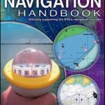
RYA Navigation Handbook
The Navigation Handbook from the Royal Yachting Association is the recommended text for anyone doing the RYA Day Skipper Shorebased course and a core text for Read More » -

Savukoski
The 1:50,000 topographic map gives a more general picture of the ground features than a basic map. It shows settlements, houses, roads, cultivated areas, waterways, cutting Read More » -

Caucasus Geographical Gizi Map
The Caucasus at 1:1,000,000 from Gizi Map, presenting the region in a geographical edition with bright altitude coloring to show its topography. Coverage includes the southern Read More » -

Indian Country NGS Wall Map PAPER
National Geographic Society’s Indian Country Wall Map of the United States presenting individual states annotated with information showing Native heritage and today’s homelands, plus historical maps Read More » -

Crossbill Guide Foundation Nature Guides
Nature guides to ecologically important regions of Europe from the Crossbill Guides Foundation, with each title combining extensive information about the regionโ€s eco-system with routes to Read More » -

1776: America and Britain at War
America`s most acclaimed historian presents the intricate story of the year of the birth of the United States of America. “1776” tells two gripping stories: how Read More » -

Peppa Pig: Peppa Plays Cricket
Can Daddy Pig train Peppa, George and Suzy to be the next Joe Root, Alastair Cook and Stuart Broad?It is a very sunny day. Perfect for Read More » -

US Luxe City Guide Travel Set: New York, Chicago and Los Angeles
Now a print/digital bundle with new covers and updated content. Keeping the great hyper-opinionated, pithy style and concertina format readers love, these new guides feature updated Read More » -

NOAA Chart 14813 – Oswego Harbor
NOAA maintains the nautical charts and publications for U.S. coasts and the Great Lakes. Over a thousand charts cover 95,000 miles of shoreline and 3.4 million Read More » -
Bradt Travel Guides (Travel Literature)
-


