Disclosure : This site contains affiliate links to products. We may receive a commission for purchases made through these links.
Disclosure : This site contains affiliate links to products. We may receive a commission for purchases made through these links.
Categories
-
Best Sellers
-

Railway Atlas of Ireland Then & Now
This new atlas compares the railway network in Ireland in 1920 with the network today. It is produced by the same authors as the successful Railway Read More » -

Seeing Further: The Story of Science and the Royal Society
Edited and introduced by Bill Bryson, with contributions from Richard Dawkins, Margaret Atwood, Richard Holmes, Martin Rees, Richard Fortey, Steve Jones, James Gleick and Neal Stephenson Read More » -

Lake Tahoe Basin NGS Wall Map PAPER
National Geographic Wall Maps offer a special glimpse into current and historical events, and they inform about the world and environment. Offered in a variety of Read More » -

A Stage Full of Shakespeare Stories
Step on to a stage full of stories with this beautiful anthology of 12 stories from Shakespeare, re told to be accessible for children. Get lost Read More » -

The How Trump Thinks: His Tweets and the Birth of a New Political Language
The most unusual feature of Donald Trump`s nationalist and populist campaign for the presidency of the USA was his obsessive use of Twitter. Like other social Read More » -

Montargis – Pannes IGN 2419SB
Topographic survey of France at 1:25,000 in IGN`s excellent TOP25 / Sรฉrie Bleue series. All the maps are GPS compatible, with a 1km UTM grid plus Read More » -

CHS Chart 6281 – Lac La Ronge
The official Canadian charts provide an excellent range of scales for the whole length of Canada`s coastline as well as the Grat Lakes and comply with Read More » -

The Valentine House
In June 1914, Sir Anthony Valentine, a keen mountaineer, arrives with his family to spend the summer in their chalet, high in the French Alps. There, Read More » -
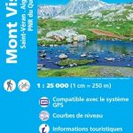
Mont Viso – Saint-Veran – Aiguilles – PNR du Queyras IGN WATERPROOF 3637OTR
Topographic survey of France at 1:25,000 in IGN`s excellent TOP25 / Sรฉrie Bleue series. All the maps are GPS compatible, with a 1km UTM grid plus Read More » -

Botswana Tracks4Africa
Botswana at 1:1,000,000 on a large, waterproof and tear-resistant map from Tracks4Africa, with roads and tracks showing both driving times and distances, plus on the reverse Read More »
-


