Disclosure : This site contains affiliate links to products. We may receive a commission for purchases made through these links.
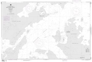
Inner Oslofjord Nordeca Watersport 5200

The Inner Oslofjord between Oslo – Drรธbak on a light, waterproof and resistant, GPS compatible double-sided map 1:25,000 from Nordeca highlighting various local recreational facilities including locations for fishing, kayaking, rowing and diving. Also marked are different types of tourist accommodation (campsites, camp grounds, tourist cabins), nature conservation sites, nudist beaches, cultural sights, etc. Road network indicates locations of car parks and the map also highlights local train stations. Topography is shown by contours at 10m intervals with colouring of woodlands and built up or cultivated areas. The map has a 1km UTM grid plus latitude and longitude lines at 5’ intervals. Map legend includes English. Accompanying booklet about the area is in Norwegian only.IMPORTANT – PLEASE NOTE: the map also indicates sea depth in the fjord and show lighthouses with sector colours, but it is not sold by Stanfords as a proper navigational chart.To see the list of Turkart maps at 1:25,000 and links to Turkart series at 50K, 100K and Hiking Sets please click on the series link above.

Related Products:
 Huldreheimen Nordeca 2489
 Fjordruta Nordeca 2607
 Forollhogna Nordeca 2731
 Lofoten Nordeca 2549
 Blefjell Nordeca 2207
 Lifjell Nordeca 2219
 Jotunheimen Nordeca 2215
 Femunden Nordeca 2559
 Rondane Nordeca 2716
 Rendalen Nordeca 2753
 Finnemarka Nordeca 2221
 Indre Ryfylke Nordeca 2790
 Hardangervidda East Nordeca 2556
 Hardangervidda West Nordeca 2558
 Folgefonna – Hardangerfjorden Nordeca 2431
 Indre Sunnfjord Nordeca 2481
 Dovrefjell East – Knutsรธ Nordeca 2710
 Sveio Nordeca 2813
 Jรธlster Nordeca 2568
 Reineskarvet Nordeca 2385
 Tafjordfjella Nordeca 2533
 Lygna Nordeca 2600
 Trondheim Nordeca 2665
 Lysefjorden Nordeca 2681
 Skarverennet Nordeca 2703
 Romeriksรฅsene Nordeca 2225
 Sirdalsheiane Nordeca 2543
 Geilo Nordeca 2515
 Hallingskarvet Nordeca 2517
 Hjelmelandsheiane Nordeca 2232
 Oslo รstmark Nordeca 2283
 Ringebu Nordeca 2509
 Aurlandsdalen Nordeca 2565
 Nesbyen Nordeca 2573
 Skarvheimen Nordeca 2661
 Eidfjord Nordeca 2677
 Rauhelleren Nordeca 2727
 ร…rdal Nordeca 2531
 Balestrand Nordeca 2810
 Froya Nordeca 2814