Disclosure : This site contains affiliate links to products. We may receive a commission for purchases made through these links.
Inland Empire – Inland Pacific Northwest WA/ID/OR
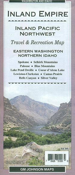
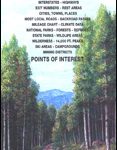
Inland Empire: Inland Pacific Northwest, WA/ID/OR road map at 1:375,000 approx. from GM Johnson Associates, covering eastern Washington State and northern Idaho, highlighting Indian reservations plus national forests and other protected areas.The map is double-sided and covers on one side eastern Washington State and the Idaho panhandle from the state highway 21 in WA to Idaho’s eastern border. On the reverse coverage continues southwards to Boise National Forest and Cascade in Idaho, and includes the north-western part of Oregon with Wallowa Mountains.Plain base with just colouring for different types of protected areas shows local roads and tracks, with driving distance on principal highways, and selected foot trails. Topography of the area is indicated by names of peaks, plateaux, deserts and other geographical features. National forests and other protected areas are prominently coloured according to their official status. Also marked are the region’s Indian Reservations. Symbols indicate various places of interest including campgrounds and picnic places, ranger stations, climbing sites, skiing areas, scenic viewpoints, etc. The map has no geographical coordinates. Extensive lists cities/towns/sites, counties, land features, water features, points of interest, recreational sites, etc.

Related Products:
 Pacific Northwest – Washington – Oregon Michelin Zoom 171
 Northwest USA – Pacific Northwest Borch
 Pacific Northwest USA 01 Hallwag Road Map
 Indian Country – the Four Corners Region AZ/CO/NM/UT
 Idaho Recreational Map
 USA Northwest – OR, WA Reise Know-How
 Washington State Benchmark Recreation Map
 Pacific Northwest NGS Adventure Map 3118
 Idaho Easy-to-Read Rand McNally
 Idaho Benchmark Recreational Map
 Idaho Easy to Fold Rand McNally
 Montana Eastern Recreational Map
 USA: Great Pacific Recreation & Travel Maps of the Pacific Northwest
 Ghost Towns of the Pacific Northwest
 Seattle & Northwest USA ITMB
 Idaho DeLorme Atlas & Gazetteer
 Washington Easy to Fold Rand McNally
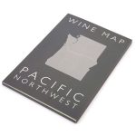 Pacific Northwest De Long Wine Map
 Virginia
 Pacific Northwest De Long Wine Wall Map
 USA – the Essential Geography of the United States of America
 Washington State Easy-to-Read Rand McNally
 New Mexico Recreational Map
 Nevada Recreational Map
 Utah Recreational Map
 Colorado Recreational Map
 USA: The Essential Geography of the United States of America Wall Map PAPER
 Arizona Recreational Map
 Washington State Recreational Atlas & Gazetteer
 USA: NGS State Maps
 Pennsylvania Recreation Atlas
 Utah Benchmark Recreation Map
 Oregon Benchmark Recreational Map
 Montana Western Recreational Map
 Maine
Maine
 California Northern
 Arizona