Disclosure : This site contains affiliate links to products. We may receive a commission for purchases made through these links.
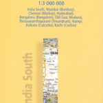
India South Nelles
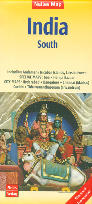
Southern India at 1:1,500,000 on a waterproof and tear-resistant, double-sided map from Nelles, in a convenient size for use when travelling. An enlargement presents Goa in greater detail, highlighting numerous beaches, and the map includes street plans of central Chennai/Madras, Bengaluru/Bangalore, Hyderabad, Thiruvananthapuram/Trivandrum and Kochi, plus a plan of the UNESCO World Heritage site at Hampi. Coverage includes Sri Lanka, plus the Andaman, Nicobar and Lakshadweep Islands on inset panels.Maps in the Nelles regional series of India present the country’s road and rail networks on a base with relief shading to show the topography. National parks and nature or game reserves are highlighted, as are numerous places of interest. Also shown are the country’s internal administrative boundaries with names of the states. Each map includes enlargements for most visited areas and/or street plans of main cities. Latitude and longitude are shown by margin ticks at 2ยฐ. None of the maps are indexed. Map legend includes English.To see other titles in this series please click on the series link.

Related Products:
 India East Nelles
 India West Nelles
 India Northeast – Bangladesh Nelles
 India: Nelles Regional Road Maps
 India North Nelles
 South Africa – Namibia – Botswana – Zimbabwe Nelles
 Indonesia: Nelles Regional Maps
 Bali – Lombok Nelles
 Java – Jakarta Nelles
 Hawaii – The Big Island Nelles
 Taiwan Nelles
USA: Nelles Maps of the Hawaiian Islands
Taiwan Nelles
USA: Nelles Maps of the Hawaiian Islands
 Hawaii – Oahu – Honolulu Nelles
Hawaii – Kauai Nelles
Hawaii – Oahu – Honolulu Nelles
Hawaii – Kauai Nelles
 Pakistan Nelles
 South America – The Andes Nelles
 Tunisia Nelles Map
Sri Lanka & India South ITMB
Tunisia Nelles Map
Sri Lanka & India South ITMB
 Hawaii – Maui – Molokai – Lanai Nelles
 Vietnam – Laos – Cambodia Nelles
Sulawesi – Nusa Tenggara – East Timor Nelles
Vietnam – Laos – Cambodia Nelles
Sulawesi – Nusa Tenggara – East Timor Nelles
 China North East Nelles Map
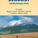 Colombia – Ecuador Nelles
 Mexico Nelles
 New Zealand Nelles
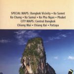 Thailand Nelles
 India South Borch
 South Pacific Islands Nelles
 Malaysia – Brunei Nelles
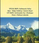 Nepal Nelles
 Korea North and South Nelles
Kenya – Serengeti Nelles
Korea North and South Nelles
Kenya – Serengeti Nelles
 India Nelles
 Bolivia – Paraguay Nelles
 Central America Nelles
 Cuba Nelles
 Venezuela, Guyana, Suriname & French Guiana Nelles Map