Disclosure : This site contains affiliate links to products. We may receive a commission for purchases made through these links.
Imray Chart: Saint Marys, Tresco and Surrounding Islands 2400.14
Chart of St Mary`s, Tresco and surrounding Islands.
Related Products:
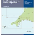 Y50 Saint Mary`s, Tresco and Surrounding Islands
 Isles of Scilly Guidebook: St Mary`s, St Agnes, Bryher, Tresco, St Martin`s
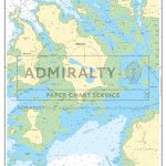 Admiralty Chart SC5603_11 – Isles of Scilly Saint Mary`s Pool to Tresco
 Imray Chart: Laminated Isles of Scilly 2400.3
 CHS Chart 4243 – Tusket Islands To Cape St Marys
 Imray Chart A232: Virgin Islands Tortola to Anegada: 2019
 2400 West Country Chart Pack – 2019 edition
 Admiralty Chart 883 – Saint Mary`s and the Principal Off-Islands
 Imray Chart A231: Virgin Islands St Thomas to Virgin Gorda: 2019
 Tresco: St Helen`s, Tean and Round Island
 Tresco – Teรคn – St Helens
 New Zealand Charts for South Island, Surrounding Islands and Antarctic Territories
 Admiralty Chart 4714 – Cocos (Keeling) Islands to Ile Saint-Paul
 Imray Chart A233: Virgin Islands Double-sided sheet combining charts A231 and A232: 2019
 Chart G – Greenland with Surrounding Waters
 Admiralty Chart 160 – Saint Abb`s Head to the Farne Islands
 Admiralty Chart 4976 – Cape Saint Elias to Shumagin Islands
 Admiralty Chart 4629 – Samoa Islands to Northern Cook Islands and Tokelau
 Admiralty Chart 3200 – Falkland Islands to South Sandwich Islands and Graham Land
 NOAA Chart 16540 – Shumagin Islands to Sanak Islands – Mist Harbor
 Admiralty Chart 4445 – Jolo Islands to Basilan Islands
 Admiralty Chart PNG398 – Tulun Islands to Tanga Islands
 Admiralty Chart 4630 – Samoa Islands to Southern Cook Islands
 NGA Chart 81141 – Palau Islands [Caroline Islands]
 NGA Chart 81338 – Truk Islands [Caroline Islands]
 NOAA Chart 530 – San Diego to Aleutian Islands and Hawai’ian Islands
 Admiralty Chart SC5603_10 – Isles of Scilly Saint Agnes to Saint Mary`s Pool
 NGA Chart 81329 – Eten Anchorage [Caroline Islands – Truk Islands]
 NGA Chart 81145 – Palau Islands Northern Part [West Caroline Islands]
 Imray UK small-format charts: 2400 series: The West Country
 NOAA Chart 530 – North America West Coast’”San Diego to Aleutian Islands and Hawai’ian Islands
 CHS Chart 6368 – Cabin Islands to Pilot Islands
 Admiralty Chart 685 – Banana Islands to Turtle Islands
 NGA Chart 29122 – Argentine Islands to Brabant Islands
 NGA Chart 29106 – Plans on the Ant. Penn. and Adj. Islands-Melchoir Islands
 NGA Chart 81345 – Mortlock Islands, East Caroline Islands
 Chart C – Denmark with Surrounding Waters
 Admiralty Chart 4622 – Admiralty Islands to Solomon Islands
 NOAA Chart 81092 – Commonwealth of the Northern Mariana Islands’”Pagan Island – Maug Islands
 NOAA Chart 83484 – Samoa Islands – Manua Islands – Pago Pago Harbor – Rose Atoll – Swains Island – Tutuila Island


