Disclosure : This site contains affiliate links to products. We may receive a commission for purchases made through these links.
Categories
-
Best Sellers
-

C48 A Coruna to Porto
Plans included: A Coruna (1:50 000) Ria de Corme e Laxe (1:75 000) Ria de Camarinas (1:50 000) Ria de Muros (1:75 000) Approaches to Ria Read More » -
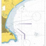
Admiralty Chart 4157 – Approaches to Port Elizabeth
Admiralty standard nautical charts comply with Safety of Life at Sea (SOLAS) regulations and are ideal for professional, commercial and recreational use. Charts within the series Read More » -
Nordurardalur
-

2600 Greenland Eastcoast – Kap Brewster to Kap Simpson
Official charts for the coast of Greenland produced by the Danish Hydrographic Office. The charts are ordered upon customer demand, therefore please contact us if you Read More » -

Santa Fe – Truchas Peak NM
Map No. 731, Santa Fe – Truchas Peak in New Mexico at 1:63,360, part of an extensive series of GPS compatible, contoured hiking maps of USA’s Read More » -

Four Seasons
Here are poets past and present, from Chaucer, Shakespeare and Wordsworth to Whitman, Dickinson and Thoreau; from Keats, Blake and Hopkins to Elizabeth Bishop, Ted Hughes Read More » -

Bilston 1913 – 62.16c
-

Olivares CNIG Topo 984-1
Topographic coverage of mainland Spain at 1:25,000 published by the Centro Nacional de Informaciรณn Geograficรก, the country’s civilian survey organization. The maps have contours at 10m Read More » -

Liverpool Edge Hill 1905
Edge Hill in 1905 in a fascinating series of reproductions of old Ordnance Survey plans in the Alan Godfrey Editions, ideal for anyone interested in the Read More » -

Bagnols-sur-Ceze – Pont-Saint-Esprit – Gorges de la Ceze IGN 2940OT
Topographic survey of France at 1:25,000 in IGN`s excellent TOP25 / Sรฉrie Bleue series. All the maps are GPS compatible, with a 1km UTM grid plus Read More »
-


