Disclosure : This site contains affiliate links to products. We may receive a commission for purchases made through these links.
Iceland: Topographic Hiking and Tourist Maps
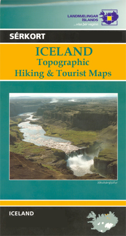
Icelandโ€s most visited areas on special detailed, GPS compatible recreational and touring maps with cartography from the countryโ€s topographic survey, highlighting hiking paths, bridleways, tourist accommodation, etc.The maps are contoured, (usually at 20m intervals) and carry all the information expected of topographic maps at such scales, including, where appropriate types of vegetation and terrain, details of lava flows, etc. Also marked are various types of tourist accommodations, places of interest, etc. The maps have grids showing lines of latitude and longitude. *For more information please see individual descriptions.*Please note: * Most titles have on the back cover a map of Iceland showing which areas are covered by this series and/or a list of relevant titles with numbers cross-referenced to the map. Recent changes in what is currently published mean that information presented there is not accurate. * Since the administrative changes at the Icelandic survey organization, Landmรฆlingar Islands, the maps are being gradually re-printed showing the brand name of Ferรฐakort. The old name of Landmรฆlingar Islands may still be quoted in some guidebooks to Iceland.

Related Products:
 Iceland: 250K Topographic Survey Road Maps
 Iceland: 100K Topographic Survey Maps
 Iceland: Mรกl og menning`s 100K Topographic Survey Maps
 Norway: Turkart 25K Topographic Hiking Maps
 Norway: Turkart 50K Topographic Hiking Maps
 Norway: Turkart 100K Topographic Hiking Maps
 Iceland: Mรกl og Menning Touring and Hiking Maps
Luxembourg: 20K Topographic Tourist Maps
Iceland: Mรกl og Menning Touring and Hiking Maps
Luxembourg: 20K Topographic Tourist Maps
 Finland: Karttakeskus Topographic Hiking Maps
 Maps of Iceland: Antique Maps of Iceland 1482-1850
 Netherlands: ANWB 25K Topographic Survey Hiking Maps
 Denmark: 100K Topographic Survey Maps
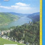
 Germany: Rhineland-Palatinate 25K Topographic Leisure Maps
 Belgium: 50K Topographic Survey Maps
 Iceland: Sogur Utgafa 100K Recreational Maps
 Iceland: Mรกl og Menning 200K Road Maps
 Russia: Topographic Maps of Elbrus and Western Caucasus
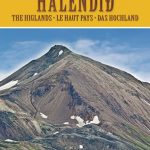 Iceland Highlands
 Switzerland: Swiss Survey 50K/33K Hiking Editions of Topographic Maps
Iceland Highlands IDNU 5
Switzerland: Swiss Survey 50K/33K Hiking Editions of Topographic Maps
Iceland Highlands IDNU 5
 Iceland North-East IDNU 3
Iceland North-West IDNU 1
Iceland South-West IDNU 2
Iceland South-East IDNU 4
Belgium: 20K Topographic Survey Maps
Iceland North-East IDNU 3
Iceland North-West IDNU 1
Iceland South-West IDNU 2
Iceland South-East IDNU 4
Belgium: 20K Topographic Survey Maps
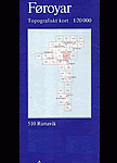 Faroe Islands: 20K Topographic Survey Maps
 Iceland 1:100,000 Complete Set (31 maps)
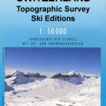 Switzerland: Swiss Survey 50K Topographic Ski Maps
 Germany: Lower Saxony 50/40K Topographic Survey Leisure Maps
 Switzerland: Swiss Survey 50K Standard Editions of Topographic Maps
 France: IGN 25K TOP25/Sรฉrie Bleue Topographic Survey Maps
 Iceland Mal og menning Tourist Map
 Germany: Hesse 50K Topographic Survey Leisure Maps
 Spain: The Way of St James 50K Topographic Survey Maps
 Nepal: 50K Topographic Survey Maps
Spain: CNIG Topographic Maps of Popular Scenic Areas
Nepal: 50K Topographic Survey Maps
Spain: CNIG Topographic Maps of Popular Scenic Areas
 Germany: Rhineland-Palatinate 50K Topographic Survey Recreational Maps
 Portugal: 50K Military Topographic Survey Maps
Norway: New 50K Topographic Survey Maps
Portugal: 50K Military Topographic Survey Maps
Norway: New 50K Topographic Survey Maps
 Peru: 100K Topographic Survey Maps