Disclosure : This site contains affiliate links to products. We may receive a commission for purchases made through these links.
Iceland: Mรกl og Menning 300K Road Maps
Iceland at 1:300,000 on five maps from Mรกl og menning showing the road network on a base with contours, coloring and graphics to provide a very clear picture of the countryโ€s topography, plus on the reverse photos and descriptions of main sights.The maps have contours at 100m intervals, enhanced by very effective relief shading and altitude colouring, plus plenty of spot heights and names of mountain ranges, peaks, glaciers, etc. Road information distinguishes between hard surface and gravel roads, includes local tracks and indicates river fords. Symbols show locations of campsites, swimming pools, thermal and hydro-electric power stations, local airfields, etc. The maps have a grid with latitude and longitude at 15` and 30` intervals respectively; the map covering the Central Highlands also has GPS waypoints for important road junctions and other sites. Map legend includes English. On the reverse of the maps there are photographs of main natural sights in the region with multilingual descriptions which include English; maps 1 to 4 also have a comprehensive distance table for the whole country; map no. 5 has instead a list of the local GPS waypoints.

Related Products:
 Iceland: Mรกl og Menning 200K Road Maps
 Iceland: Mรกl og Menning Touring and Hiking Maps
 Iceland: Mรกl og menning`s 100K Topographic Survey Maps
 Iceland Central Highlands
 Iceland North East
 Iceland South West
 Iceland North West
Iceland South East
Iceland North West
Iceland South East
 Iceland Mal og menning Road Atlas 2021-2023
 Spain: Mairdumont 300K Regional Road Maps
 Iceland Mal og menning Tourist Map
 Estonia: Regio 275K Regional Road Maps
 Iceland: 250K Topographic Survey Road Maps
 Iceland Western Fjords
 Iceland South-West: Reykjavik ‘“ Eyjafjallajรถkull
 Iceland North: Hvammstangi – Mรฝvatn Lake
 Iceland 1:100,000 Complete Set (31 maps)
 Iceland West: Akranes – Eirรญksjรถkull Glacier
 Iceland East: Vatnajรถkull – Egilsstaรฐir
 Iceland South East: Southern Vatnajรถkull
 Iceland Cental: Langjรถkull – Hofsjรถkull – Vatnajรถkull
 Iceland North East: Hรบsavik – Lake Mรฝvatn – Bakkagerรฐi
 Austria: Freytag & Berndt 150K “Top 10 Tips” Road Maps
 Poland: Michelin Regional Road Maps
 Spain: Michelin Zoom Espaรฑa Road Maps
 Germany: Marco Polo 200K Regional Road Maps
Italy: Freytag & Berndt “Top 10 Tips” Road Maps
Germany: Marco Polo 200K Regional Road Maps
Italy: Freytag & Berndt “Top 10 Tips” Road Maps
 India: ITMB Regional Road Maps
 USA: Borch Regional Road Maps
 Australia: Hema State Road Maps
 Ukraine: Kartografija 500K Road Maps
 Italy: Ed. Multigraphic 100K Road Maps of Tuscany & Adjoining Areas
 India: Eicher State Road Maps
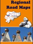 Spain: Michelin Regional Road Maps
 New Zealand: Kiwimaps District Road Maps with Street Plans
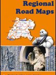 Portugal: Michelin Regional Road Maps
France: Michelin 150K Local Road Maps
Portugal: Michelin Regional Road Maps
France: Michelin 150K Local Road Maps
 France: Michelin 200K Regional Road Maps
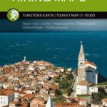 Slovenia: Kartografija 75K Hiking Maps