Disclosure : This site contains affiliate links to products. We may receive a commission for purchases made through these links.
Iceland F&B World Compact Map
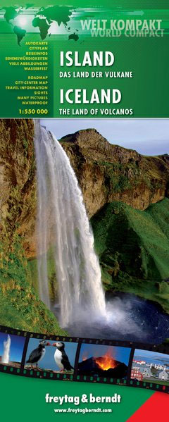
Iceland at 1:550,000 on light, waterproof at tear-resistant map published by Freytag & Berndt in their ‘World Compact” series which combines a country map with street plans and extensive tourist information: descriptions of places of interest, a fact-box, etc.The map is double-sided, with a small overlap between the sides. Topography is very effectively shown by relief shading with contours and spot heights, plus colouring for glaciers and plenty of names of geographical features. National parks and other protected areas are highlighted. Road network indicates roads with hard, gravel and loose surface, includes selected mountain tracks, and gives distances on main routes. Locations of petrol stations and river fords are marked. Icons indicate numerous places of tourist interest such as campsites, youth hostels, mountain cabins and shelters, geysers, UNESCO World Heritage sites, etc. The map is indexed and has latitude and longitude lines drawn at 30’ and 1ยฐ intervals respectively.A special feature of Freytag & Berndt’s World Compact series are additional street plans and information panels, illustrated with colour photos, with descriptions of main tourist destinations, important natural features, facts and figures about the country, a phrase book, tourist tips, etc. The map of Iceland includes a street plan of central Reykyavik.Map legend and all the text in the information panels is bilingual English ‘“ German.

Related Products:
 Iceland Michelin
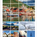
 Iceland F&B
 Iceland Touring Map
 Europe F&B Compact Road Atlas
 Iceland Road Guide
 Central Europe F&B Compact Road Atlas
 Inn Bike Trail: Landeck – Passau Freytag & Berndt Map
 New Zealand Kiwimaps Compact Travellers Atlas SPIRAL-BOUND
 Latvia Jana Seta Compact Road Atlas
 Tauern Bike Trail: Krimml – Passau Freytag & Berndt Map
 Lithuania Jana Seta Compact Road Atlas
 Iceland Road Atlas 500K
 Graz F&B
 Kamp – Thaya – March Bike Trail Freytag & Berndt Map
 Iceland Flexi Map
 Germany: Freytag & Berndt “Top 10 Tips” Road Maps
 Reykjavik & SW Iceland ITMB
 La Palma F&B
 Iceland ITMB
 Iceland Reise Know-How
 World Political F&B
 Iceland Geological Map
 Faroe Islands
 Linz F&B
 Caribbean Cruises F&B
 Maps of Iceland: Antique Maps of Iceland 1482-1850
 Iceland North East
 Iceland South West
 Iceland North West
Iceland South East
Iceland North West
Iceland South East
 Austria: Freytag & Berndt Cycling Maps
 Austria: Freytag & Berndt 150K “Top 10 Tips” Road Maps
 Iceland Mal og menning Tourist Map
 Crete F&B Top 10 Tips
 Carinthia F&B Top 10 Tips
 Iceland Central Highlands
 Iceland Highlands
 Burgenland F&B Top 10 Tips
 Salzburg State F&B Top 10 Tips
 Argentina F&B