Disclosure : This site contains affiliate links to products. We may receive a commission for purchases made through these links.
Categories
-
Best Sellers
-

Admiralty Chart SC5608_16 – Bristol Deep to King Road
NEWAdmiralty Small Craft nautical charts comply with Safety of Life at Sea (SOLAS) regulations and are ideal for professional, commercial and recreational use. Charts within the Read More » -

Murder at the Manor: Country House Mysteries
The English country house is an iconic setting for some of the greatest British crime fiction. Short stories are an important part of this tradition, and Read More » -

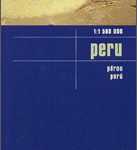
Peru Reise Know-How
Peru at 1:1,500,000 on an indexed, waterproof and tear-resistant road map with topographic and tourist information, published by Reise Know-How as part of their highly acclaimed Read More » -

Flag of Canada
Flags are a great way to show some national pride, pay homage to a fondly remembered visit abroad, celebrate a special occasion, or simply decorate the Read More » -

Sticker Picture Atlas of the World
An interactive journey around the world, on which children can place stickers of landmarks, animals and people in the right places, learning more about the world Read More » -

Afghan Frontier
`The most dangerous place in the world` – Barack Obama. The borderlands of Afghanistan and Pakistan have become the arena for a global conflict with consequences Read More » -

The Particular Sadness of Lemon Cake
On the eve of her ninth birthday, Rose Edelstein bites into her mother`s homemade lemon-chocolate cake and discovers she has a magical gift: she can taste Read More » -

Tales From the South China Seas
This work chronicles the adventures of the last generation of British men and women who went East to seek their fortunes. Drawn into the colonial territories Read More » -

Svalbard North
The northern part of the Svalbard (Spitsbergen) group at 1:250,000 in a new series of five topographic maps first published by the Norsk Polarinstitutt in late Read More » -

Misa
Topographic survey of Portugal at 1:100,000 from the Instituto Geogrรกfico Portuguรชs, the country’s civilian survey organisation. The maps have contours at 50m intervals and in addition Read More »
-


