Disclosure : This site contains affiliate links to products. We may receive a commission for purchases made through these links.
Hyderabad
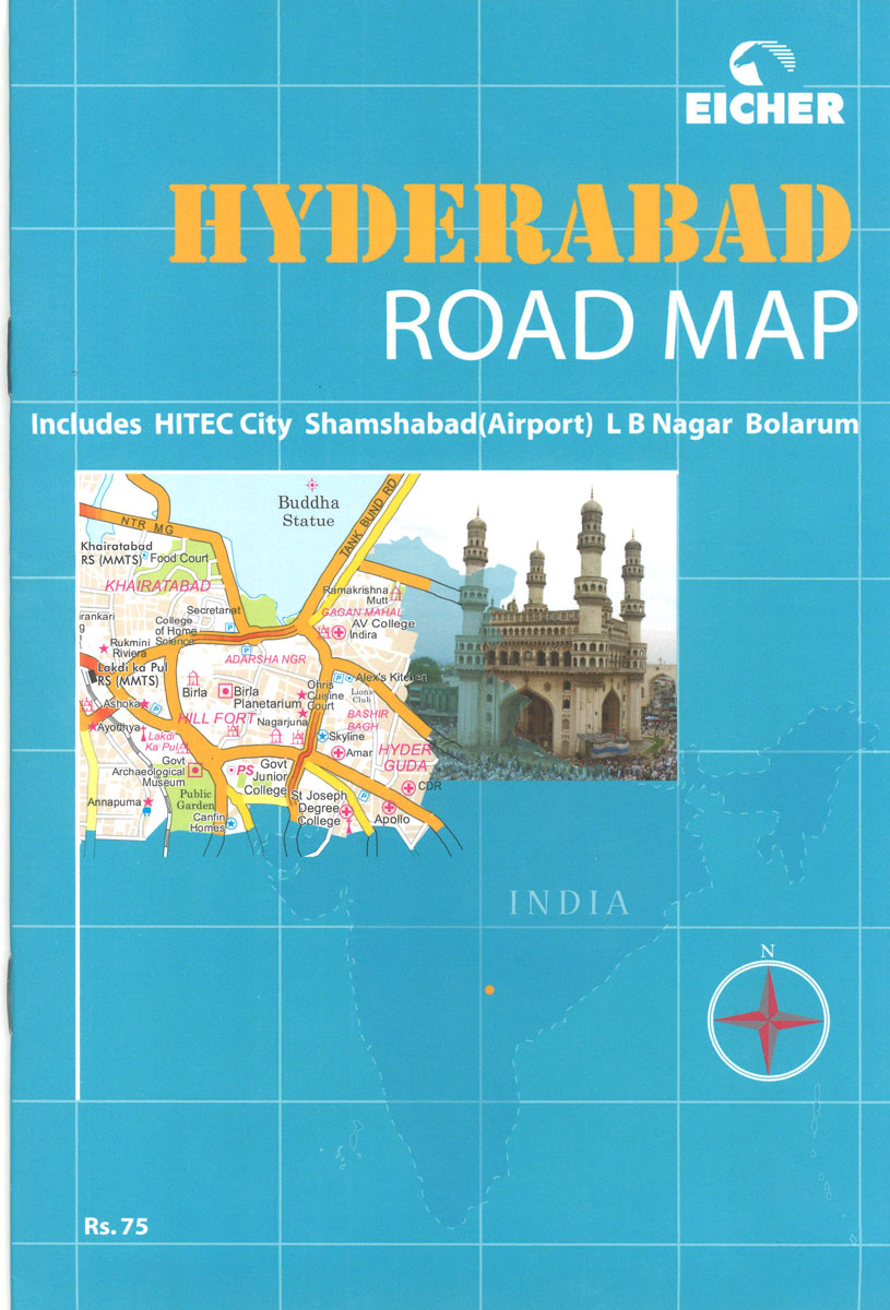
Hyderabad and Secunderabad on an indexed street plan at 1:41,700 approx. from Eicher with enlargements of the city centre and the Cyberbad Hitech City area, plus a road map of Andhra Pradesh, and a 16-page booklet describing the city’s sights.On one side is a street plan covering the whole city at 1:41,700 approx. Coverage includes Secunderabad and extends south to show the Rajiv Gandhi International Airport. Coverage includes Shamshabad, LB Nagar and Bolarum. The plan has a 2km grid to make distances easier to judge, gives names of main streets and colonies, and highlights various facilities and places of interest. Three panels present most visited areas in greater detail: two sections of central Hyderabad plus the Cyberbad Hitech City area.On the reverse is a map showing locations of Vodafone stores in Hyderabad, plus a road and rail map of Andhra Pradesh state.The accompanying booklet provides notes on the city and its sights, plus useful contact details including several hotels.

Related Products:
 Chennai (Madras)
 Andhra Pradesh
 Salzburg F&B Street Plan
 Sikkim & India Northeast ITMB
 Uttar Pradesh Map-Guide
 Madhya Pradesh Map-Guide
 Zaragoza
 Albany City & County, NY
 Bamberg in 3-D Street Plan
 A Guide to the Heritage of Hyderabad
 Dushanbe
 Trier in 3-D Street Plan
 Lisbon Borch
 Aachen in 3-D Street Plan
 Cres – Losinj – Krk – Rab F&B Top 10 Tips
 New Orleans Borch
 Bishkek Street Plan
 Moscow Jana Seta Street Plan
 Stuttgart in 3-D Street Plan
Singapore Borch
Stuttgart in 3-D Street Plan
Singapore Borch
 Kathmandu City – Patan – Bhaktapur
 Munich in 3-D Street Plan
 Lรผbeck in 3-D Street Plan
 Larmaka Street Plan and District Road Map
 Montreal
 La Gomera F&B
 Cape Town Map Studio Pocket Map
 Cologne in 3-D Street Plan
 Figueres
 Hanover in 3-D Street Plan
 Rhodes F&B
 Seville (Spanish Edition)
 Taif/At Taif
 Munich F&B
 Florence Michelin City Map
 Valencia
 Dusseldorf in 3-D Street Plan
 Rome TCI Pocket Plan
 Munich F&B Wall Map
 Hamburg in 3-D Street Plan