Disclosure : This site contains affiliate links to products. We may receive a commission for purchases made through these links.
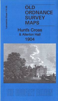
Hunt`s Cross & Allerton Hall 1904 – 114.09

Related Products:
 Allerton Bywater 1905 – 234.02
 Chapel Allerton 1919 – 203.10b
 On Courage: Stories of Victoria Cross and George Cross Holders
 Wolf Hall – The Wolf Hall Trilogy: Winner of the 2009 Man Booker Prize
 Allerton 1905
 Forest Hall 1913 – 32
 Araminta Spook: Gargoyle Hall
 Birkenshaw & Oakwell Hall 1905: Yorkshire Sheet 232.02
 Clifton & Kirklees Hall 1905: Yorkshire Sheet 231.16
 Don`t Cross the Line!
 Sisters of the Cross
 Waltham Cross 1896 – 41.12
 Curious King`s Cross
 Burley Cross Postbox Theft
 Clay Cross (North) 1913 – 30.07
 Clay Cross (South) 1914 – 30.11
 St George`s Cross 20 Flag Bunting
 We`re Going on an Egg Hunt
 Brixham 1904 – 128.02
 Wrexham 1904 – 121
 Swansea Bay 1904 – 247
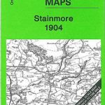 Stainmore 1904 – 31
 Rhossili Bay 1904 – 246
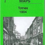 Totnes 1904 – 121.05
 Davyhulme 1904 – 103.15b
 Treasure Hunt
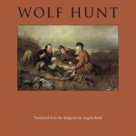 Wolf Hunt
 We`re Going on a Bear Hunt
 The Hunt Guides
 Wolf Hall
 The Hippo at the End of the Hall
 Coleraine (North) 1904 – 7.03
 Rhyl & Colwyn Bay 1904 – 95
 Shrewsbury & The Wrekin 1904 – 152
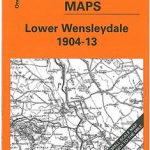 Lower Wensleydale 1904-13 – 51
 Vale of Glamorgan 1904 – 262
 Coleraine (South) 1904 – 7.07
 USA: Map Maps Long-Distance Cross-Country Touring Routes
 Mr Impossible and the Easter Egg Hunt
 Hall Green 1903