Disclosure : This site contains affiliate links to products. We may receive a commission for purchases made through these links.
Hungary – Budapest Road Atlas SPIRAL-BOUND
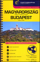
Road atlas of Hungary at 1:250,000 combined with a street atlas of Budapest at 1:20,000 from Cartographia, presented in a handy glovebox size and spiral-bound format, each section with an extensive index, plus an enlargement of the Budapest region, etc.The road atlas section shows six different classes of roads, plus cart tracks and selected local footpaths. The maps indicate toll roads, scenic routes, sections closed to motorized traffic, gradients, locations of LPG fuel supplies, and driving distances on most local roads. Roads with a bicycle path and recommended cycle touring routes are also marked. Railway lines are shown with stations and stops. Narrow gauge lines, funiculars and ski lifts are included and on Lake Balaton ferry routes are marked. Picturesque towns or villages and other places of interest, including national parks and protected areas, are highlighted. Symbols mark locations of campsites and youth hostels, castles and churches, folk museums, spas, swimming pools, etc. The maps have no geographical coordinates. Extensive index lists all the localities with their postcodes and gives population details. The atlas includes an enlargement presenting the environs of Budapest (extending north to include Esztergom and Visegrad) in greater detail, plus a comprehensive distance table.The section with the street atlas of Budapest at 1: 20,000 shows tram, bus and trolleybus routes with stops and line numbers; metro and suburban railway stations also have line numbers. For drivers, the atlas indicates main traffic arteries, one way streets, pedestrianized zones, and car parks. Streets are annotated with selected house numbers for easier identification of addresses. Important buildings are highlighted and named, and symbols indicate other places of interest and/or facilities. Extensive index includes lists with addresses of museums and other cultural or educational establishments, embassies, etc. Also provided is a diagram of the city’s nighttime public transport lines.Map legends for the two sections and other explanatory text include English.PLEASE NOTE: both the road atlas and the street atlas are also available separately.


