Disclosure : This site contains affiliate links to products. We may receive a commission for purchases made through these links.
Hull North East 1908
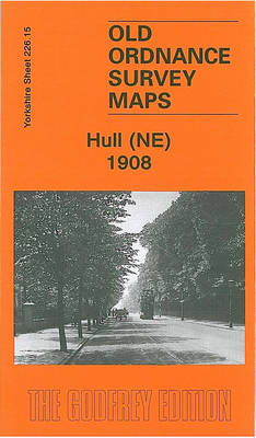
Hull North East in 1908 in a fascinating series of reproductions of old Ordnance Survey plans in the Alan Godfrey Editions, ideal for anyone interested in the history of their neighbourhood or family. The map covers a busy north-eastern area of Hull, stretching from Cannon Street station northward to Lorraine Street, and from St Paul`s Street eastward to New Bridge Road. Holderness Road runs through the map, as does a winding portion of the River Hull, lined with mills, wharves and factories. Features include stretches of the Hull & Barnsley Railway, the North Eastern Railway with Wilmington station and goods sheds; tramways, Wilmington, Sulcoates Cemetery, Hull Municipal Hospital (almshouses), Thistleton, cement works, Summergangs, Reckitt`s Kingston Works, Wincolmlee Colour Works, the Foredyke Stream, Holderness House, St Mary`s church, Cannon Street station and approaches, Stoneferry Canister Works, etc. On the reverse are street directories for Cleveland Street, Cumberland Street, Durham Street, Oxford Street and Swann Street. About the Alan Godfrey Editions of the 25″ OS Series:Selected towns in Great Britain and Ireland are covered by maps showing the extent of urban development in the last decades of the 19th and early 20th century. The plans have been taken from the Ordnance Survey mapping and reprinted at about 15 inches to one mile (1:4,340). On the reverse most maps have historical notes and many also include extracts from contemporary directories. Most maps cover about one mile (1.6kms) north/south, one and a half miles (2.4kms) across; adjoining sheets can be combined to provide wider coverage.FOR MORE INFORMATION AND A COMPLETE LIST OF ALL AVAILABLE TITLES PLEASE CLICK ON THE SERIES LINK.

Related Products:
 Hull (East) 1908 – 240.03b
 Northwich North East 1908
 Hull Alexandra Dock 1908
 Hull (East) 1928 – 240.03c
Hull (East) 1890 – 240.03a Colour Edition
Worcester North-East 1902
Hull (East) 1928 – 240.03c
Hull (East) 1890 – 240.03a Colour Edition
Worcester North-East 1902
 Hull West 1928
 Hull (Hessle Road) 1928 – 240.06b
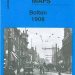
 Bolton North 1908
Hull West 1890 (Colour Edition)
Bolton North 1908
Hull West 1890 (Colour Edition)
 Southampton (East) 1908 – 65.11a
Middlesbrough North 1913
Willenhall North East 1885
Southampton (East) 1908 – 65.11a
Middlesbrough North 1913
Willenhall North East 1885
 Beverley North 1908
Middlesbrough North 1893 (Colour Edition)
Gateshead East 1895
Glasgow East End 1893
Beverley North 1908
Middlesbrough North 1893 (Colour Edition)
Gateshead East 1895
Glasgow East End 1893
 Bury North 1908
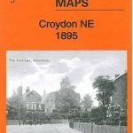 Croydon North-East 1895
Carlisle North-East 1924
Knutsford North 1908
Leeds Central and North East 1890
Plymouth North 1893
North Shields and Chirton 1894
Manchester North West and Central Salford 1915
East Ham & Barking 1915 – 44.3
Croydon North-East 1895
Carlisle North-East 1924
Knutsford North 1908
Leeds Central and North East 1890
Plymouth North 1893
North Shields and Chirton 1894
Manchester North West and Central Salford 1915
East Ham & Barking 1915 – 44.3
 Hull Old Town 1853
Birmingham North 1913
Hull Old Town 1853
Birmingham North 1913
 Bolton 1908 – 87.13b
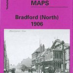 Bradford North 1906
Manchester South-East 1915
Stockton (North) 1899 – 50.12a
Hull (Queen`s Dock) 1853 – 8
Barnsley North East 1904
Norwich (North) 1905 – 63.11
Bradford North 1906
Manchester South-East 1915
Stockton (North) 1899 – 50.12a
Hull (Queen`s Dock) 1853 – 8
Barnsley North East 1904
Norwich (North) 1905 – 63.11
 Uckfield 1908
Glasgow North East 1893
Uckfield 1908
Glasgow North East 1893
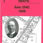 Sale South-West 1908
Swindon South-East 1899
Sale South-West 1908
Swindon South-East 1899
 Ebbw Vale North 1899