Disclosure : This site contains affiliate links to products. We may receive a commission for purchases made through these links.
Hull (Hessle Road) 1928 – 240.06b
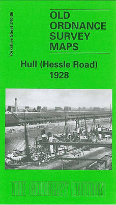
Hull Hessle Road 1928 in a fascinating series of reproductions of old Ordnance Survey plans in the Alan Godfrey Editions, ideal for anyone interested in the history of their neighbourhood or family. Two versions have been published for this area, with the 1890 version in full colour, taken from the beautiful hand-coloured 1st Edition OS map. The maps cover the southern area of Hull along Hessle Road and including several of the docks. Coverage stretches from Hawthorn Avenue eastward to the Albert Dock Basin, and from Woodcock Street southward to the Humber. Features include Holy Trinity Burial Ground, tramways and depot, St Andrew`s Dock, William Wright Dock with graving dock, Albert Dock, Neptune Street station, many warehouses and sidings with full track layout given, St James church, Billingsgate goods station, Subway Junction, St Barnabas church, wagon works, etc. Adjacent sheet 240.07 is included as an inset. On the reverse are selections of directory entries; on the 1890 map including the St Andrew`s Dock entry. About the Alan Godfrey Editions of the 25″ OS Series:Selected towns in Great Britain and Ireland are covered by maps showing the extent of urban development in the last decades of the 19th and early 20th century. The plans have been taken from the Ordnance Survey mapping and reprinted at about 15 inches to one mile (1:4,340). On the reverse most maps have historical notes and many also include extracts from contemporary directories. Most maps cover about one mile (1.6kms) north/south, one and a half miles (2.4kms) across; adjoining sheets can be combined to provide wider coverage.FOR MORE INFORMATION AND A COMPLETE LIST OF ALL AVAILABLE TITLES PLEASE CLICK ON THE SERIES LINK.

Related Products:
 Hull (East) 1928 – 240.03c
 Hull West 1928
 Hull (East) 1890 – 240.03a Colour Edition
Hull (East) 1908 – 240.03b
Hull West 1890 (Colour Edition)
Hull (East) 1890 – 240.03a Colour Edition
Hull (East) 1908 – 240.03b
Hull West 1890 (Colour Edition)
 Hull Alexandra Dock 1908
Central Liverpool 1890 – 106.14a Colour Edition
Hull Alexandra Dock 1908
Central Liverpool 1890 – 106.14a Colour Edition
 Hull North East 1908
Hull (Queen`s Dock) 1853 – 8
Hull North East 1908
Hull (Queen`s Dock) 1853 – 8
 Central Liverpool 1906 – 106.14b
 Kingston upon Hull – Barton-upon-Humber – Beverley A-Z Street Atlas
 Doncaster South 1928 – 285.01b
 Hull Old Town 1853
Leeds South and South East 1890 (Colour Edition)
Belfast North 1920
West Hartlepool 1914 – 37.11c
Hull Old Town 1853
Leeds South and South East 1890 (Colour Edition)
Belfast North 1920
West Hartlepool 1914 – 37.11c
 Swansea 1897 – 24.05
Central Glasgow 1934 – 6.10c
Central Glasgow 1893 – 6.10a
Central Glasgow 1909 – 6.10b
Swansea 1897 – 24.05
Central Glasgow 1934 – 6.10c
Central Glasgow 1893 – 6.10a
Central Glasgow 1909 – 6.10b
 Hull: Yorkshire`s Maritime City
Aberdeen 1900 – 75.11
Hull: Yorkshire`s Maritime City
Aberdeen 1900 – 75.11
 Kirkdale 1906
Bootle Docks & Seaforth 1907 – 99.13
Kirkdale 1906
Bootle Docks & Seaforth 1907 – 99.13
 Liverpool North 1906
 Goole 1905
 Liverpool Toxteth 1906
 An Historical Map of Kingston Upon Hull
 Hull (Kingston upon Hull), Beverley & Driffield OS Landranger Map 107 (paper)
 Hull (Kingston Upon Hull), Beverley & Driffield OS Landranger Active Map 107 (waterproof)
Wigan 1928 – 93.08c
Hull (Kingston Upon Hull), Beverley & Driffield OS Landranger Active Map 107 (waterproof)
Wigan 1928 – 93.08c
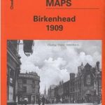 Birkenhead 1909 – 13.03b
Barnsley 1890 (Colour Edition)
Poplar 1894 – 65.2
Birkenhead 1909 – 13.03b
Barnsley 1890 (Colour Edition)
Poplar 1894 – 65.2
 Poplar 1914 – 65.3
Wakefield (North) 1890 – 248.03a
Poplar 1914 – 65.3
Wakefield (North) 1890 – 248.03a
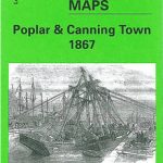 Poplar & Canning Town 1867 – 65.1
 Rotherhithe 1868 – 78.1
 Rotherhithe 1894 – 78.2
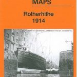 Rotherhithe 1914 – 78.3