Disclosure : This site contains affiliate links to products. We may receive a commission for purchases made through these links.
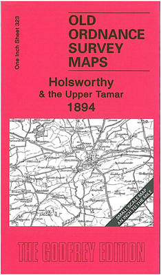
Holsworthy & the Upper Tamar 1894 – 323
Related Products:
 Middle Tamar and Caradon 1894
 Upper Holloway 1894 – 29.2
 Upper Sydenham 1894 – 137.2
 Upper Edmonton 1894 – 3a
 Norbury and Upper Norwood 1894
 Crystal Palace, Anerley and Upper Norwood 1894 – 145
 Launceston & Holsworthy – Roadford Lake OS Explorer Map 112 (paper)
 Bude, Clovelly, Boscastle & Holsworthy OS Landranger Map 190 (paper)
 Launceston & Holsworthy – Roadford Lake OS Explorer Active Map 112 (waterproof)
 Bude, Clovelly, Boscastle & Holsworthy OS Landranger Active Map 190 (waterproof)
 Boot Up The Tamar Valley
 Cornish Mines: Gwennap to the Tamar
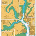 Admiralty Chart 871 – Rivers Tamar Lynher and Tavy
 Lower Tamar Valley & Plymouth – Tavistock & Callington OS Explorer Map 108 (paper)
 Admiralty Chart AUS168 – River Tamar Long Reach to Launceston
 Lower Tamar Valley & Plymouth – Tavistock & Callington OS Explorer Active Map 108 (waterproof)
 The Upper World
 Southampton (Upper Shirley) 1931 – 65.02
 Trekking Around Upper & Lower Mustang
 Leslie 1894 – 27.03
 Kinghorn 1894 – 40.08
 Aberdour 1894 – 40.09
 Runcorn 1894 – 115.13a
 Burntisland 1894 – 40.06
 Gospel Oak 1894 – 28.1
 Doncaster 1894 – 88
 The Lizard 1894 – 359
 Yiewsley 1894
 Alston Moor & Upper Weardale 1903 – 25
 Cupar 1894: Part 2
 Hillingdon (North) 1894
 Glasgow (Hillhead) 1894 – 6.06a
 Glasgow Green 1894 – 6.15a
 Muswell Hill 1894 – 11.2
 The Hartland Peninsula 1894 – 307/308
 Mevagissey 1894-1905 – 353
 Cranborne Chase 1894 – 314
 Brighton & District 1894 – 318
 Gateshead South 1894 – 23a
 Davos – St. Moritz – Oberengadin / Upper Engadine K+F Hiking Map 36


