Disclosure : This site contains affiliate links to products. We may receive a commission for purchases made through these links.
Holborn & The City 1895 – 62.2
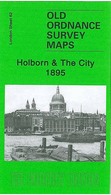
Holborn and the City in 1895 in a fascinating series of reproductions of old Ordnance Survey plans in the Alan Godfrey Editions, ideal for anyone interested in the history of their neighbourhood or family. Three versions cover an area stretching from the British Museum eastward to Guildhall, and from Clerkenwell Road southward to Waterloo Bridge. Features include Covent Garden, Lincoln`s Inn Fields; Blackfriars, Ludgate Hill, Holborn Viaduct and Aldersgate stations; Southwark and Blackfriars Bridges; part of Bloomsbury; Fleet Street, The Strand, Somerset House, St Paul`s Cathedral, The Temple, Smithfield, Cheapside, etc. The 1873 map has street directories for Fleet St, Holborn and Strand; the 1895 version has directories for Drury Lane, Fleet Street and Ludgate Hill; and the 1914 map has entries for Fleet St, Kingsway and Strand. About the Alan Godfrey Editions of the 25″ OS Series:Selected towns in Great Britain and Ireland are covered by maps showing the extent of urban development in the last decades of the 19th and early 20th century. The plans have been taken from the Ordnance Survey mapping and reprinted at about 15 inches to one mile (1:4,340). On the reverse most maps have historical notes and many also include extracts from contemporary directories. Most maps cover about one mile (1.6kms) north/south, one and a half miles (2.4kms) across; adjoining sheets can be combined to provide wider coverage.FOR MORE INFORMATION AND A COMPLETE LIST OF ALL AVAILABLE TITLES PLEASE CLICK ON THE SERIES LINK.

Related Products:
 Holborn, The City & The Strand 1914 – 62.3
 Holborn, The City & The Strand 1873 – 62.1
 Central Croydon 1895 – 14.10
 Houghton le Spring 1895
Durham City North: Framwellgate Moor 1895
Houghton le Spring 1895
Durham City North: Framwellgate Moor 1895
 Hanger Hill 1895
Brightlingsea 1895
South Shields 1895
Enfield (South) 1895 – 7.07a
Hanger Hill 1895
Brightlingsea 1895
South Shields 1895
Enfield (South) 1895 – 7.07a
 Loughton (South) 1895 – 57.16
Sunderland South 1895
Mouth of the Tyne 1895
Cullercoats and Whitley 1895
Loughton (South) 1895 – 57.16
Sunderland South 1895
Mouth of the Tyne 1895
Cullercoats and Whitley 1895
 South Croydon 1895 – 14.14
 South Croydon 1895 – 159.2
Chester-le-Street 1895 – 13.09a
South Croydon 1895 – 159.2
Chester-le-Street 1895 – 13.09a
 Camberley 1895
Harton 1895
Winchester 1895 – 41.13
Byker and Heaton 1895
Camberley 1895
Harton 1895
Winchester 1895 – 41.13
Byker and Heaton 1895
 Finchley and Holders Hill 1895
Gateshead Fell & Sheriff Hill 1895 – 7.05a
Guildford 1895
Finchley and Holders Hill 1895
Gateshead Fell & Sheriff Hill 1895 – 7.05a
Guildford 1895
 Croydon NW 1895 – 154
 South Norwood 1895
 Croydon East: Coombe Park & Addiscombe Road 1895 – 158
Pelton and Urpeth 1895
Jesmond 1895
Stanley 1895
New Eltham 1895 – 8.06
Croydon East: Coombe Park & Addiscombe Road 1895 – 158
Pelton and Urpeth 1895
Jesmond 1895
Stanley 1895
New Eltham 1895 – 8.06
 Godalming 1895
Hetton Downs and Rainton Bridge 1895
Godalming 1895
Hetton Downs and Rainton Bridge 1895
 Addington Hills & Croham Hurst 1895
East Boldon 1895
Wembley Park 1895
Hetton-le-Hole and East Rainton 1895
Rowlands Gill 1895
Gateshead East 1895
Ryhope Village 1895
Central Sunderland 1895 – 8.14
Addington Hills & Croham Hurst 1895
East Boldon 1895
Wembley Park 1895
Hetton-le-Hole and East Rainton 1895
Rowlands Gill 1895
Gateshead East 1895
Ryhope Village 1895
Central Sunderland 1895 – 8.14