Disclosure : This site contains affiliate links to products. We may receive a commission for purchases made through these links.
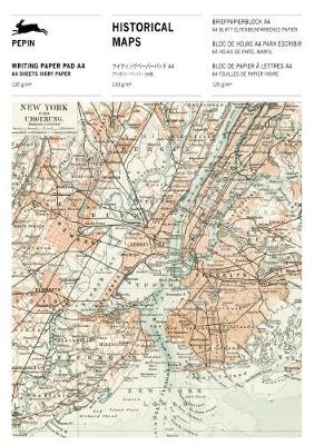
Historical Maps: Writing Paper & Note Pad A4

Related Products:
 Historical Maps: Writing Paper & Note Pad A5
 Old Folding Maps Reproductions of Historical Maps
 Historical Maps: Label & Sticker Book
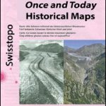 Switzerland: Swisstopo “Once and Today” Historical Maps
 Historical Maps of Alnwick & Alnmouth – from Earliest Times to 1918
 Poland/Czech Republic: Hรถfer 200K Road Maps with Historical Place Names
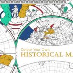 Colour Your Own Historical Maps
 Great Britain: Cassini Historical Reproductions of Ordnance Survey One-Inch Maps of England & Wales
 Great Britain: Godfrey Editions of Historical Ordnance Survey Inch to a Mile Maps of England & Wales
 Tierra del Fuego Historical Maps
 Maps – Letter Writing Set
 Maps: Gift and Creative Paper Book: Vol 23
 Great Britain: OS 25K Explorer Maps (Paper and Waterproof Editions)
 Great Britain: OS 50K Landranger Maps (Paper and Waterproof Editions)
 Travels with a Writing Brush: Classical Japanese Travel Writing from the Manyoshu to Basho
 A Sticky Note Guide to Life
 A Sweet, Wild Note: What We Hear When the Birds Sing
 The Nutcracker: Press the Note to Hear Tchaikovsky`s Music
 Antarctica Maps International Wall Map PAPER
 Europe XYZ Maps Political Wall Map PAPER
 Maine Raven Maps Physical Wall Map PAPER
 New York Raven Maps Physical Wall Map PAPER
 Arizona Raven Maps Physical Wall Map PAPER
 Hawaii Raven Maps Physical Wall Map PAPER
 Idaho Raven Maps Physical Wall Map PAPER
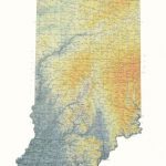 Indiana Raven Maps Physical Wall Map PAPER
 Louisiana Raven Maps Physical Wall Map PAPER
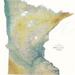 Minnesota Raven Maps Physical Wall Map PAPER
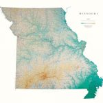 Missouri Raven Maps Physical Wall Map PAPER
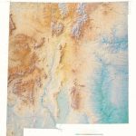 New Mexico Raven Maps Physical Wall Map PAPER
 Utah Raven Maps Physical Wall Map PAPER
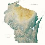 Wisconsin Raven Maps Physical Wall Map PAPER
 Oklahoma Raven Maps Physical Wall Map PAPER
 Kansas Raven Maps Physical Wall Map PAPER
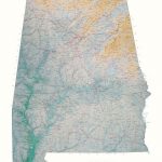 Alabama Raven Maps Physical Wall Map PAPER
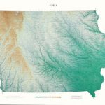 Iowa Raven Maps Physical Wall Map PAPER
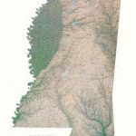 Mississippi Raven Maps Physical Wall Map PAPER
 Africa Maps International Political Wall Map PAPER
 Asia Maps International Political Wall Map PAPER
 British Isles Maps International Planning Map PAPER